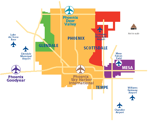
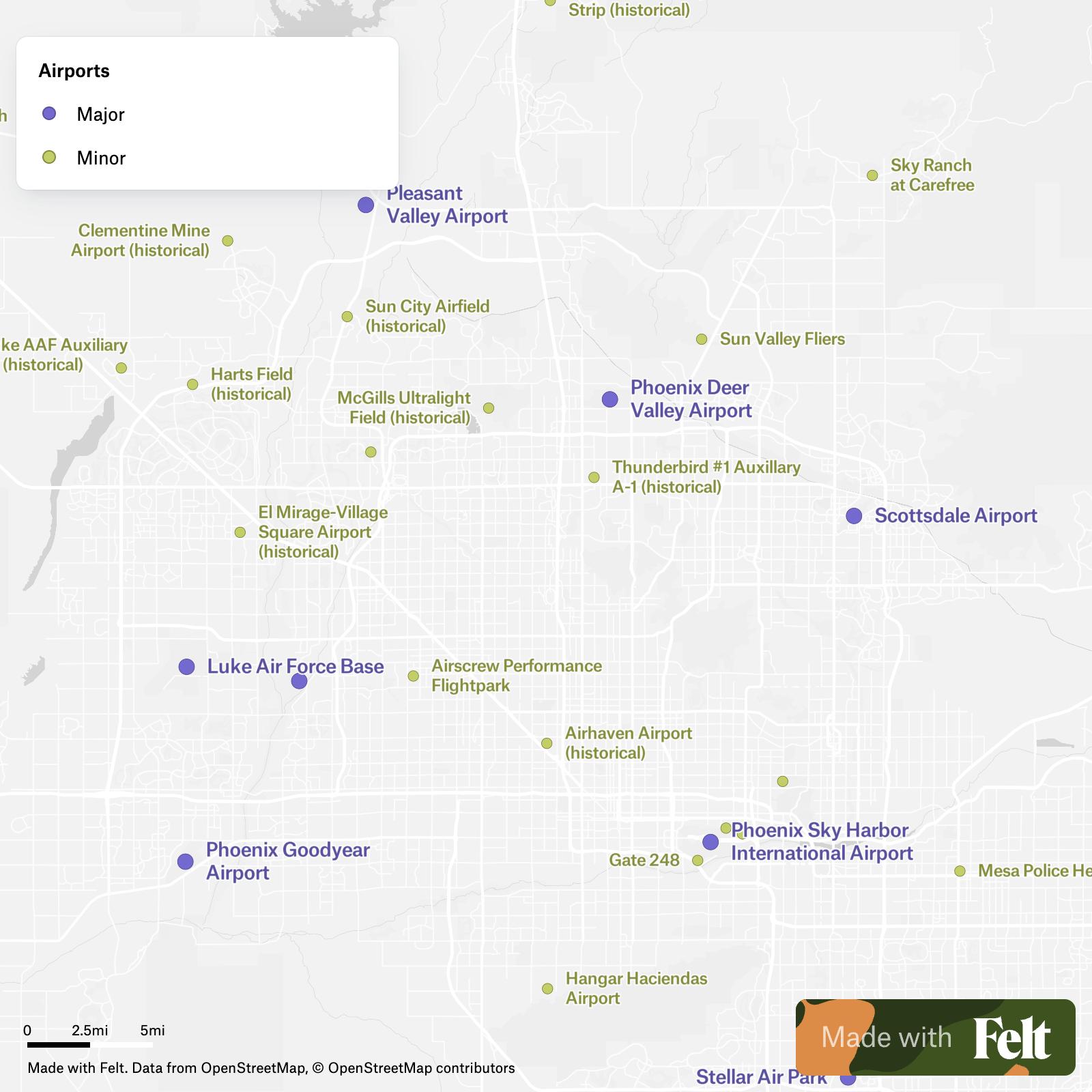
Arizona boasts a vibrant aviation scene, essential for connecting its sprawling cities and facilitating tourism to its iconic landscapes. Understanding the distribution of airports across the state is crucial for both residents and visitors. A map of Arizona’s airports reveals a network catering to diverse needs, from large international hubs to smaller regional and private airfields. Phoenix Sky Harbor International Airport (PHX) dominates the map as Arizona’s, and one of the nation’s, busiest airports. Located in the heart of Phoenix, it serves as a major hub for American Airlines and Southwest Airlines, offering extensive domestic and international connections. The map would clearly show its central location and its radiating network of routes. Tucson International Airport (TUS) is another prominent point on the map, serving Southern Arizona. Although smaller than PHX, TUS offers a significant number of direct flights to major US cities and some international destinations, making it a vital gateway for the region. Beyond these major hubs, a cluster of regional airports dot the map, serving smaller cities and towns. These airports are crucial for connecting communities that are geographically isolated and rely on air travel for business, medical access, and personal travel. Airports like Yuma International Airport (YUM) in southwestern Arizona, Flagstaff Pulliam Airport (FLG) in northern Arizona near the Grand Canyon, and Prescott Regional Airport (PRC) in central Arizona, each serve as crucial links in the state’s transportation network. Their locations on the map highlight their strategic importance in connecting these communities to larger urban centers. The map would also indicate a significant number of smaller municipal and private airports, often serving general aviation purposes. These airports cater to private pilots, flight schools, and air charter services. They are vital for recreational flying, aerial tours, and emergency services like air ambulance operations. Examples include Scottsdale Airport (SDL), a busy general aviation airport in the Phoenix metropolitan area, and numerous smaller airfields scattered across the state, often found in more remote areas. Analyzing a map of Arizona’s airports reveals more than just their locations. It highlights the state’s dependence on air travel due to its vast distances and varied terrain. The distribution of airports reflects the population density, economic activity, and tourism patterns across Arizona. Moreover, the presence of military airfields, such as Luke Air Force Base near Phoenix, would also be visible, underscoring the state’s role in national defense. In conclusion, a map of Arizona airports provides a valuable overview of the state’s aviation infrastructure. From the bustling international hubs to the smaller regional and private airfields, the network demonstrates Arizona’s commitment to connecting its communities and facilitating access to its natural wonders. The map illustrates the importance of air travel in overcoming geographical challenges and supporting the state’s economy and tourism industry.