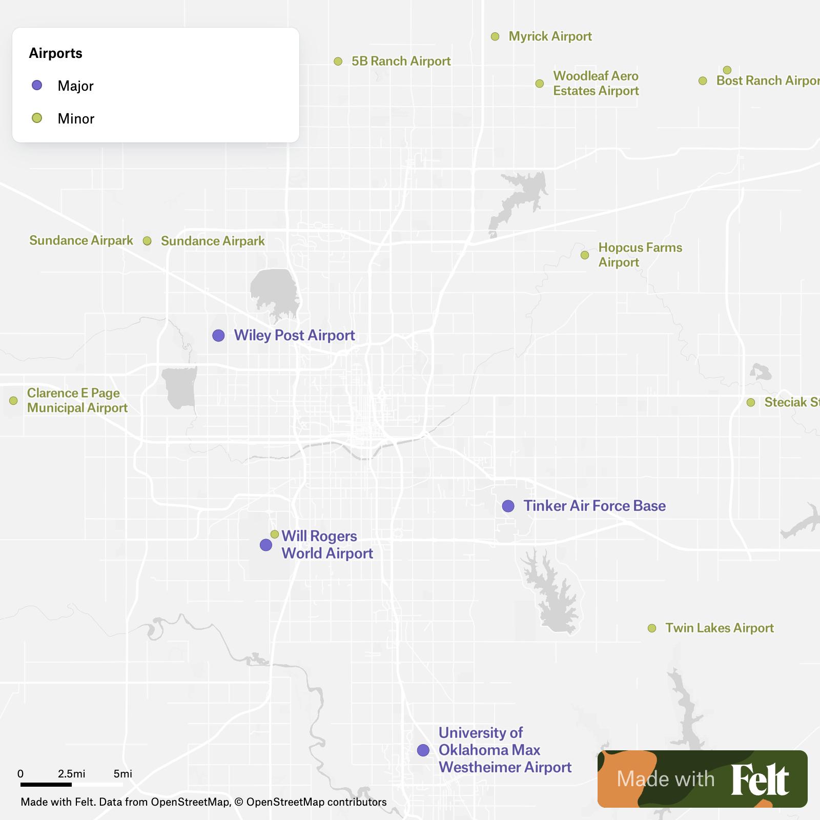
Oklahoma, nestled in the heart of the United States, boasts a robust aviation network crucial for both commercial and private travel. A map highlighting Oklahoma’s airports reveals a comprehensive system connecting communities across the state and facilitating access to national and international destinations.
Oklahoma’s primary air hub is Will Rogers World Airport (OKC) in Oklahoma City. As a major commercial airport, OKC offers numerous daily flights to cities across the country via airlines like Southwest, American, Delta, and United. The airport features modern amenities, including multiple terminals, parking options, restaurants, and shops, catering to the needs of both domestic and international travelers. Its strategic location makes it a central point for travel within the Southern Plains.
Tulsa International Airport (TUL) serves as the second major commercial airport in Oklahoma. Located in Tulsa, TUL provides a significant number of flights to various U.S. cities. This airport also offers a range of services to passengers, including comfortable waiting areas, dining options, and car rental facilities. Its presence is essential for the economic activity of northeastern Oklahoma.
Beyond the primary hubs, Oklahoma’s airport map showcases a network of regional and municipal airports that support general aviation and smaller commercial operations. Examples include Lawton-Fort Sill Regional Airport (LAW), which provides commercial air service to Lawton and the surrounding area, connecting it to larger hubs. Smaller airports like Stillwater Regional Airport (SWO) and Enid Woodring Regional Airport (WDG) offer vital connections for local communities and businesses, serving as important entry points for visitors and residents alike.
The numerous smaller general aviation airports scattered throughout Oklahoma are crucial for private pilots, agricultural operations, and emergency services. These airports often provide fuel, maintenance, and hangar services, supporting a wide range of aviation activities. They play a key role in connecting rural communities and facilitating access to essential services, such as medical transport and disaster relief.
An airport map of Oklahoma also illustrates the importance of location relative to population centers and major industries. Airports located near industrial parks, universities, and tourism destinations contribute significantly to local economies by facilitating business travel, attracting tourism, and supporting the transportation of goods. For instance, airports near the oil and gas industry in western Oklahoma support the logistics and personnel movement associated with those operations.
Understanding the layout and capabilities of Oklahoma’s airport network is essential for businesses, travelers, and government agencies. By visually representing the location and type of airports across the state, an airport map provides valuable insights into the infrastructure that supports Oklahoma’s connectivity and economic growth. As Oklahoma continues to develop, its airport infrastructure will remain a critical component of its overall transportation system.


.png)