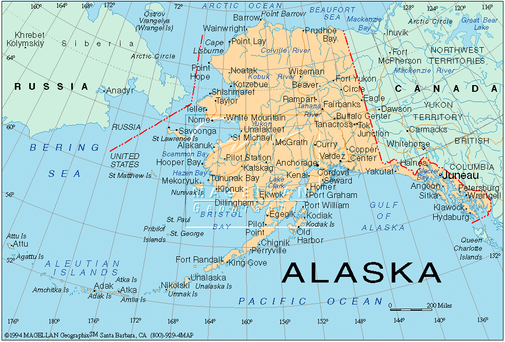
The map of Alaska and Canada reveals a vast and geographically diverse landscape. Bordering each other, these two regions share a complex and intertwined history, reflected in their cartography and their overlapping ecological zones. Understanding their relationship requires appreciating their individual characteristics and their shared features.
Alaska, the largest state in the United States, dominates the northwestern corner of North America. Its defining feature is its rugged mountain ranges. The Alaska Range, home to Denali (Mount McKinley), the highest peak in North America, stretches across the south-central region. This range acts as a barrier, influencing weather patterns and creating distinct ecosystems. Coastal Alaska, including the panhandle, is characterized by temperate rainforests and numerous islands, shaped by glacial activity and the Pacific Ocean. The interior of Alaska is primarily boreal forest, transitioning to tundra in the north, bordering the Arctic Ocean. The map also reveals extensive river systems, crucial for transportation and resource extraction, most notably the Yukon River.
Canada, directly east and south of Alaska, is the second-largest country in the world. Its western provinces, particularly British Columbia and Yukon Territory, directly border Alaska and share similar geographical characteristics. The Coast Mountains, a continuation of the Alaskan ranges, run along the Pacific coast of British Columbia. Further east, the Canadian Rockies dominate the landscape, forming a significant part of the continental divide. Yukon Territory mirrors the interior Alaskan environment with its boreal forests and tundra, also fed by the Yukon River. The vast Mackenzie River system, the longest in Canada, drains much of the Northwest Territories and flows into the Arctic Ocean.
The shared border between Alaska and Canada is largely defined by longitude and latitude, running through mountainous terrain and remote wilderness. This has historically posed challenges for border demarcation and management. Indigenous communities, such as the First Nations and Alaska Natives, traditionally inhabited areas that straddle the current border, reflecting a deep cultural connection that transcends political boundaries. The map illustrates how these communities are spread across both regions, demonstrating their integral role in the region’s history and ongoing management.
Examining a map also highlights the distribution of natural resources. Both Alaska and Canada are rich in minerals, oil, and gas. Resource extraction has significantly shaped the economies of both regions, but has also raised environmental concerns about habitat destruction and climate change. The Arctic regions of both Alaska and Canada are particularly vulnerable to the impacts of warming temperatures, threatening ice sheets, permafrost, and the traditional ways of life of indigenous populations. Shipping routes through the Northwest Passage, once impassable, are becoming increasingly navigable due to melting sea ice, opening up new possibilities and posing new challenges for both nations.
Ultimately, the map of Alaska and Canada is not just a representation of geography; it’s a record of geological history, cultural interactions, economic development, and environmental change. It reveals the interconnectedness of these regions and the importance of cross-border cooperation in addressing the challenges and opportunities that lie ahead.