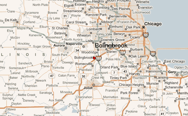
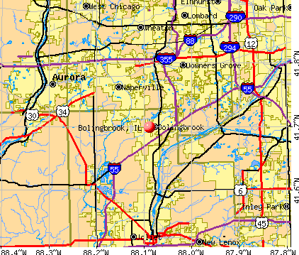
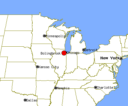
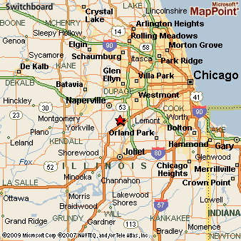
Bolingbrook, Illinois, is a large and diverse suburb located southwest of Chicago. Understanding its layout is crucial for residents and visitors alike. The map of Bolingbrook reveals a carefully planned community with a mix of residential neighborhoods, commercial centers, and industrial parks. One of Bolingbrook’s defining features is its extensive park system. These green spaces are distributed throughout the village, providing recreational opportunities and aesthetic appeal. Prominent parks include Hidden Lakes Trout Farm, a popular spot for fishing, and the sprawling Bolingbrook Golf Club, which also offers event spaces and dining. These parks, clearly marked on any comprehensive map, serve as community hubs and enhance the quality of life for residents. The major roads and highways play a significant role in defining Bolingbrook’s geography. Interstate 55 (I-55) runs along the eastern edge of the village, providing easy access to Chicago and other surrounding areas. Route 53 (Bolingbrook Drive) is a major north-south artery that bisects the village, connecting residential areas with commercial districts. Boughton Road and Weber Road are other key thoroughfares that contribute to the overall transportation network. Navigating Bolingbrook effectively relies on familiarity with these roads. Commercial activity is largely concentrated along these main roads. The Promenade Bolingbrook, an outdoor shopping mall located near I-55 and Boughton Road, is a significant retail and entertainment destination. Various shopping centers and restaurants are also scattered along Route 53, Weber Road, and other major streets. The map indicates a clear concentration of commercial zones in specific areas, allowing for efficient planning of shopping trips and errands. Residential areas in Bolingbrook are generally well-defined, with distinct neighborhoods characterized by varying housing styles and community amenities. Many neighborhoods feature subdivisions with single-family homes, townhouses, and apartment complexes. These residential zones are often interwoven with smaller parks, schools, and community centers, creating a balanced and livable environment. The map illustrates a deliberate separation between residential and industrial areas, minimizing potential conflicts. Industrial parks are primarily located on the south and west sides of Bolingbrook, away from residential neighborhoods. These areas house various businesses, from manufacturing facilities to distribution centers. Their strategic location near major highways facilitates efficient transportation of goods. The map highlights the zoning regulations that contribute to this separation of land use, ensuring that industrial activities do not negatively impact residential areas. Beyond the major roads and parks, the map of Bolingbrook also reveals the presence of various schools, libraries, and other public institutions. These facilities are strategically located throughout the village to serve the needs of the residents. The Bolingbrook branch of the Fountaindale Public Library District, for example, is a significant resource for the community. Schools are dispersed throughout the neighborhoods, ensuring convenient access for students. In conclusion, the map of Bolingbrook paints a picture of a well-planned and organized community. The layout emphasizes a balance between residential areas, commercial centers, industrial parks, and green spaces. Major roads provide efficient transportation, while parks and community facilities enhance the quality of life for residents. Understanding the geographical layout of Bolingbrook, as revealed by its map, is essential for navigating the village and appreciating its unique character.