
Ajo, Arizona, a town steeped in mining history and nestled in the Sonoran Desert, presents a unique cartographic landscape. Understanding Ajo requires more than just identifying streets; it involves recognizing the interplay of geography, industry, and community. While readily available online map services offer standard road views, a deeper exploration reveals layers of history and significance.
The core of Ajo is characterized by its historic town plaza, a circular layout radiating outwards. This Spanish Colonial design, unusual for an American town, is a prominent feature on any map. Key landmarks such as the Ajo Plaza, the Curley School artisan apartments (formerly the Curley School), and the Immaculate Conception Church surround this central point. Mapping the town involves understanding the pedestrian-friendly scale and the clustering of shops, restaurants, and community centers around this historic heart.
Beyond the plaza, maps reveal the grid-like pattern of residential streets, largely laid out to serve the once-booming mining population. Areas like “New Town” and older sections reflect periods of growth and decline tied directly to the fortunes of the New Cornelia Mine. Disconnected from the main townsite are the abandoned mine areas, evident on maps as vast, irregular spaces marked by tailings piles and remnants of industrial infrastructure. These areas, though mostly off-limits, hold significant historical and environmental weight.
Surrounding Ajo are expansive tracts of desert, dominated by the Organ Pipe Cactus National Monument to the south. Maps highlight the sparse road network traversing this arid landscape, showcasing the isolation and natural beauty that define the region. Understanding the terrain is crucial for navigation, with washes and mountainous regions posing challenges for unpaved routes. Camping and hiking areas within the monument, along with points of interest like Quitobaquito Springs, are usually clearly indicated.
More detailed maps, sometimes available locally at the Ajo District Chamber of Commerce, may highlight specific features like hiking trails, birdwatching locations, and points of geological interest. These maps are invaluable for visitors looking to explore the natural wonders beyond the town itself. They also serve as a vital tool for understanding water resources, as the scarcity of water is a defining characteristic of the region. Even subtle variations in vegetation, detectable on some maps, can indicate access to underground water sources.
Ultimately, mapping Ajo is about more than just pinpointing locations. It is about appreciating the town’s resilience, its connection to the desert environment, and its rich history. Online maps provide a functional overview, but immersing oneself in local maps and engaging with the community is essential for truly understanding the cartography of this unique Arizona town.
 338×338 ajo arizona area map from www.thedirectory.org
 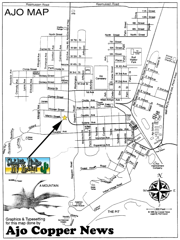 584×778 ajo map shadow ridge rv park from shadowridgerv.com
  612×612 ajo arizona street map from www.landsat.com
  474×474 arizona map ajo from www.lahistoriaconmapas.com
  1261×734 blue roads journal copper story ajo arizona part from wheeledhorizons.blogspot.com
  400×300 mapa de arizona de ajo from fity.club
  801×512 road ajo arizona from roy-and-marilyn.blogspot.com
  530×1509 map ajo az hometown hop deviantart from www.deviantart.com
  1588×1191 antique ajo arizona geological survey topographic map etsy from www.etsy.com
  300×300 places ajo arizona from www.bestplaces.net
  1024×1024 ajo az scale map united states geological survey from store.avenza.com
  1300×956 ajo map res stock photography images alamy from www.alamy.com
 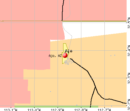 422×359 ajo arizona az profile population maps real estate from www.city-data.com
  1300×899 ajo arizona map united states america timeless from www.alamy.com
  550×419 ajo mountain drive arizona aktuelle lohnt es sich mit fotos from www.tripadvisor.de
  768×593 ajo az genuine charming from arizonajourney.org
  1043×1280 ajo arizona usgs topo map reprint az quad from shop.old-maps.com
  1112×1390 ajo arizona map cut stock images pictures alamy from www.alamy.com
  264×264 ajo az from www.bestplaces.net
  1300×889 ajo arizona map res stock photography images alamy from www.alamy.com
  800×641 ajo mountain drive organ pipe cactus park love rv blog from www.loveyourrv.com
  709×711 map ajo az arizona from townmapsusa.com
  600×371 ajo peak mountain information from www.mountain-forecast.com
  420×350 ajo profile ajo az population crime map from www.idcide.com
  1060×1390 map ajo res stock photography images alamy from www.alamy.com
  612×612 aerial photography map ajo az arizona from www.landsat.com
  1900×950 ajo visit arizona from www.visitarizona.com