
“`html Exploring Alamosa, Colorado: A Map-Based Overview
Alamosa, Colorado, nestled in the heart of the San Luis Valley, offers a blend of small-town charm, natural beauty, and historical significance. Understanding its layout is key to appreciating all it has to offer. Let’s explore Alamosa using a virtual map.
Downtown Alamosa: The Heart of the City
The city’s core centers around Main Street. Here, you’ll find a mix of locally-owned businesses, restaurants, and historical buildings. The Rio Grande Avenue and 6th Street intersection is a central point, easily identifiable on any map. Look for landmarks like the Alamosa County Courthouse and the restored train depot, now a visitor center. Parking can be found along Main Street and adjacent side streets. Walking is the best way to experience the downtown area.
Education and Recreation: Adams State University and Cole Park
A significant feature of Alamosa is Adams State University, located east of downtown. The university campus occupies a large area, and its presence influences the cultural and economic landscape. Adjacent to the university is Cole Park, a spacious green area offering recreational opportunities. The map will show roads like Edgemont Boulevard bordering the university and providing access to the park.
Residential Areas: Grid-Like Structure
The residential areas of Alamosa generally follow a grid pattern, making navigation relatively simple. North of Main Street, you’ll find established neighborhoods with tree-lined streets. Newer residential developments are expanding to the east and west of the city center. Examining a map reveals the organized street layout, making it easy to find specific addresses.
Transportation: US Highway 160 and the Rio Grande Railroad
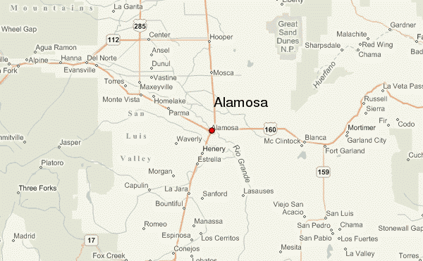
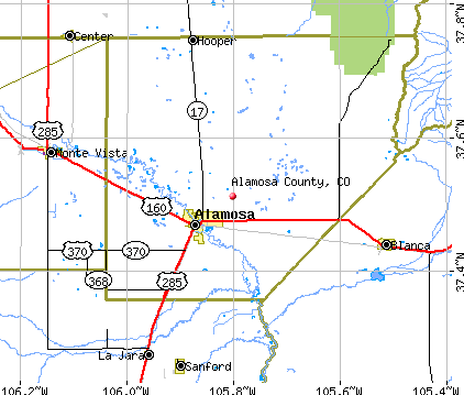
US Highway 160 is a major thoroughfare that runs east-west through Alamosa. This highway connects Alamosa to surrounding communities and attractions. The Rio Grande Railroad also plays a role in Alamosa’s history and transportation network. While not as prominent as in the past, the railway tracks and associated infrastructure are still visible on a map, especially in the industrial areas north of downtown.
Beyond the City Limits: Gateway to the San Luis Valley
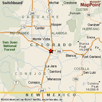
Alamosa serves as a gateway to the wider San Luis Valley. A map reveals its proximity to attractions like the Great Sand Dunes National Park and Preserve, located northeast of the city. The map also highlights the agricultural landscape surrounding Alamosa, with vast fields and irrigation canals defining the valley’s character. The Rio Grande River, winding through the valley, is another prominent feature visible on the map.
In conclusion, studying a map of Alamosa provides valuable insight into its layout, key landmarks, and relationship to the surrounding San Luis Valley. From the bustling downtown to the tranquil residential areas and the nearby natural wonders, Alamosa offers a diverse experience for residents and visitors alike.
“`
 612×612 alamosa colorado street map from www.landsat.com
  641×641 aerial photography map alamosa colorado from www.landsat.com
  338×338 alamosa colorado area map from www.thedirectory.org
  857×1200 alamosa colorado map blue poster outward cartography displate from displate.com
  600×371 alamosa location guide from de.weather-forecast.com
  449×237 hotels alamosa colorado great sand dunes from www.americansouthwest.net
  422×359 alamosa county colorado detailed profile houses real estate cost from www.city-data.com
  800×800 alamosa county map colorado map alamosa county from www.mapsofworld.com
  1500×1101 large detailed map alamosa county colorado stock vector royalty from www.shutterstock.com
  3545×2600 alamosa county wall map premium style marketmaps mapsalescom from www.mapsales.com
  1024×614 map alamosa county colorado stock illustration image from www.istockphoto.com
  803×803 map alamosa county colorado located cities population from www.whereig.com
  612×392 large detailed map alamosa county colorado usa stock from www.istockphoto.com
  1331×1690 map alamosa county colorado stock vector illustration road from www.dreamstime.com
  612×490 detailed infographic map alamosa county colorado usa stock from www.istockphoto.com
  3400×1994 alamosa topographical map colorado usa from www.yellowmaps.com
  300×300 places alamosa colorado from www.bestplaces.net
  576×369 detailed map alamosa county colorado usa stock illustration from www.dreamstime.com
  600×440 maps alamosa county colorado marketmapscom from www.marketmaps.com
  1000×1080 map alamosa county colorado royalty vector image from www.vectorstock.com
  302×226 alamosa colorado location from www.billyland.com
  3541×2600 alamosa county wall map color cast style marketmaps mapsalescom from www.mapsales.com
  850×533 satellite map alamosa county from www.maphill.com
 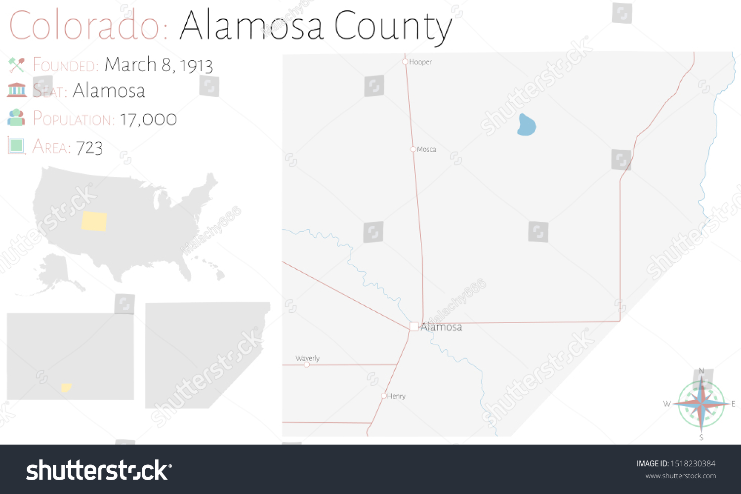 1500×1000 large detailed map alamosa county royalty stock vector from avopix.com
  850×584 classic style map alamosa county from www.maphill.com
  850×584 political map alamosa county from www.maphill.com
  800×480 map alamosa county colorado stock vector illustration from www.dreamstime.com
  700×1080 map alamosa county colorado royalty vector image from www.vectorstock.com
  474×342 alamosa county colorado map towns uncover colorado from www.uncovercolorado.com
  850×533 physical map alamosa county from www.maphill.com