
Alliance, Ohio, a city nestled in Stark County, boasts a rich history and a vibrant community best understood through its geographical layout. Understanding the map of Alliance reveals much about its past, present, and potential future.
Historically, Alliance’s development was significantly shaped by its location at the intersection of several major railroad lines. This strategic position fueled its growth as a manufacturing hub. Looking at a map, you can still discern the remnants of this railway influence, with industrial areas clustered around the old rail corridors that bisect the city. These corridors, once bustling with freight trains, now often serve as trucking routes, continuing to support local industry.
The downtown area, centered around East Main Street, remains the heart of Alliance. The map highlights a grid-like street pattern, a common characteristic of many planned cities of the era. This traditional design facilitates easy navigation and encourages pedestrian traffic. The location of City Hall and the historic buildings around the downtown square reflect its role as the civic and commercial center of the city. Recent revitalization efforts focus on enhancing this central area, with new businesses and public spaces aiming to draw residents and visitors alike.
The University of Mount Union plays a crucial role in shaping the city’s landscape. Located prominently on the west side of Alliance, its presence is unmistakable on any map. The university’s sprawling campus contributes significantly to the local economy and provides cultural and intellectual stimulation. The residential areas surrounding the university often cater to student populations, featuring a mix of housing options.
The residential areas of Alliance are generally located outward from the central core. Older, more established neighborhoods feature tree-lined streets and a mix of architectural styles. Newer subdivisions are typically found on the city’s periphery, offering modern housing options and often incorporating green spaces and parks. The distribution of these residential areas reflects the city’s gradual expansion over time.
Parks and recreational areas are sprinkled throughout the city, offering residents opportunities for outdoor activities. Silver Park, a large park located on the southeast side of Alliance, is a significant feature on the map. Its location provides easy access for residents on the south and east sides of the city, offering a valuable green space for leisure and recreation.
Major roadways, such as State Route 62 and State Route 183, serve as important arteries for transportation and commerce. These routes connect Alliance to neighboring communities and facilitate the movement of goods and people in and out of the city. The accessibility provided by these roadways is vital for the economic health of Alliance.
In conclusion, the map of Alliance, Ohio, provides a valuable snapshot of the city’s past, present, and future. From its railway heritage to its thriving university and its network of residential neighborhoods and parks, the geographical layout of Alliance reflects a community that is both historically rooted and continually evolving.
 612×612 alliance ohio street map from www.landsat.com
  300×300 alliance from www.bestplaces.net
  641×641 aerial photography map alliance ohio from www.landsat.com
  1300×956 alliance ohio map res stock photography images alamy from www.alamy.com
  1280×1669 map alliance ohio curtis wright maps from curtiswrightmaps.com
 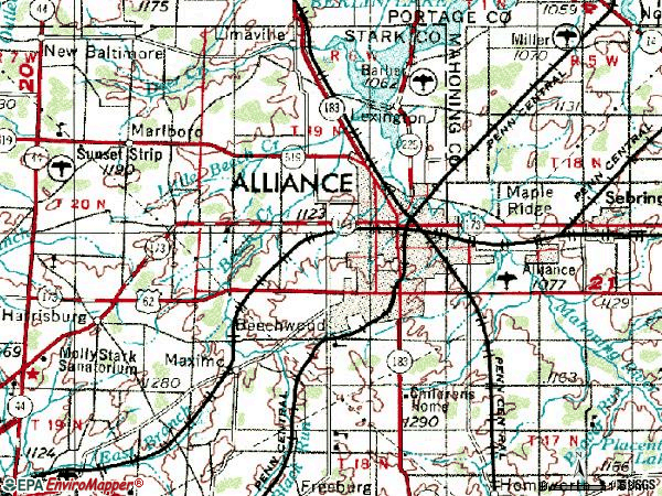 600×450 zip code alliance ohio profile homes apartments schools from www.city-data.com
 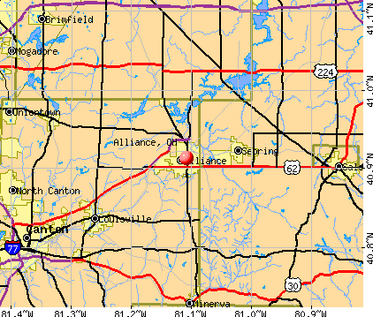 422×359 alliance ohio profile population maps real estate from www.city-data.com
  857×1200 alliance ohio city map poster picture metal print paint gigi from displate.com
  625×365 trails alliance ohio alltrails from www.alltrails.com
  280×392 alliance ohio city map poster gigi bgm displate from displate.com
  264×264 places alliance ohio from www.bestplaces.net
  620×1000 alliance ohio city limits map mary chute blog from storage.googleapis.com
  338×338 alliance ohio area map from www.thedirectory.org
  250×297 alliance ohio american football fandom from americanfootballdatabase.fandom.com
  570×713 alliance ohio city map from www.jennasuedesign.com
  1001×1390 alliance ohio map united states america timeless from www.alamy.com
  831×711 map alliance ohio from townmapsusa.com
  580×438 alliance communities world war from web.mit.edu
  1627×1926 map alliance ohio secretmuseum from www.secretmuseum.net
  200×242 res interactive map alliance pastmaps from pastmaps.com
  300×400 alliance ohio original vintage usgs topo map ebay from www.ebay.com
 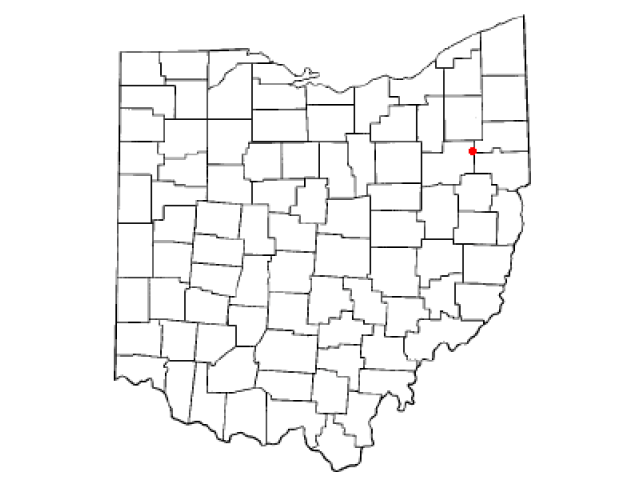 640×480 alliance geographic facts maps mapsofnet from www.mapsof.net
  450×380 alliance ohio from www.mapsofworld.com
  250×214 alliance ohio facts kids from kids.kiddle.co