
Atlantic County, New Jersey, a vibrant region on the Jersey Shore, is best understood through its geographical features. Mapping the county reveals a diverse landscape, ranging from bustling urban centers to serene coastal stretches and expansive farmlands.
At the heart of Atlantic County lies Atlantic City, a renowned destination known for its boardwalk, casinos, and beaches. The island city is connected to the mainland by a series of bridges and causeways, showcasing a blend of urban development and coastal access. Heading west from Atlantic City, the landscape transitions to more suburban and rural areas.
The county’s coastline, stretching along the Atlantic Ocean, defines much of its character. Long stretches of sandy beaches, punctuated by inlets and bays, are a defining feature. The Great Egg Harbor Bay, a significant waterway, borders several municipalities, offering opportunities for boating, fishing, and other water-based activities. The Edwin B. Forsythe National Wildlife Refuge, encompassing a large portion of the southern coast, is visible on the map as a protected natural area, crucial for migratory birds and wildlife.
Inland, the map reveals a network of roads connecting various towns and communities. The Atlantic City Expressway (Route 446) provides easy access to Atlantic City from the western portions of the state. The Garden State Parkway (Route 444), a major north-south highway, also runs through the county, facilitating travel to other parts of New Jersey. Major county roads like Route 9 and Route 30 provide local connectivity.
Further inland, the map showcases the agricultural areas of Atlantic County. The southern and western portions of the county are dotted with farmlands and cranberry bogs. Hammonton, known as the “Blueberry Capital of the World,” is prominently located on the map, reflecting its agricultural significance. The map indicates the presence of various smaller towns and villages scattered throughout the county, each with its distinct character.
The map also highlights the presence of waterways, including the Mullica River, which forms the county’s northern border with Burlington County. This river and its surrounding wetlands contribute to the ecological diversity of the area. Batsto Village, a historical site located along the Mullica River, is marked on the map, offering a glimpse into the region’s industrial past.
Beyond major roads and towns, a detailed map reveals a network of smaller roads, parks, and forests. Wharton State Forest, partially located within Atlantic County, is shown as a large green space, providing opportunities for outdoor recreation. The map also indicates the presence of various smaller parks and recreational areas scattered throughout the county, offering residents and visitors a chance to enjoy the natural beauty of the region.
By studying a map of Atlantic County, one gains a comprehensive understanding of its geographical features, its diverse communities, and its blend of urban, coastal, and rural landscapes. It offers a valuable tool for planning trips, exploring the region, and appreciating the unique character of this corner of New Jersey.
 300×250 atlantic county municipalities map nj italian heritage commission from www.njitalianheritage.org
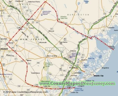 477×391 atlantic county jersey map from www.countymapsofnewjersey.com
 1046×1984 atlantic county map jersey county maps from uscountymaps.com
 700×465 private investigator atlantic county nj from www.magnuminvestigations.net
 106×200 atlantic county nj newspapers obituaries from ldsgenealogy.com
 1910×2490 image map atlantic county jersey state mays landing from east-usa.com
 1140×760 vintage atlantic county nj map jersey map etsy from www.etsy.com
 250×188 atlantic county nj map premium style from www.deliverymaps.com
 825×635 atlantic county jersey map cram mays landing atlantic from www.mygenealogyhound.com
 243×179 atlantic county nj zip code digital map basic from www.zipcodemaps.com
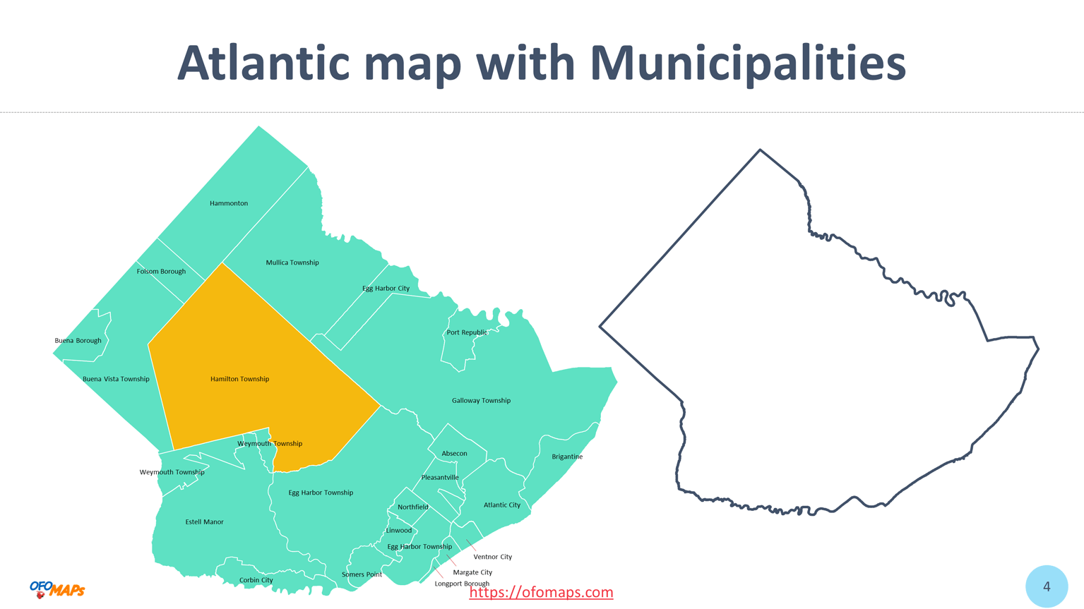 1535×863 atlantic city nj zip code map fancie shandeigh from pearleopippy.pages.dev
 600×436 atlantic county nj zip code map premium from www.deliverymaps.com
 300×270 atlantic nj town prints from www.old-maps.com
 5664×6000 atlantic nj wall map from www.old-maps.com
 728×425 atlantic county jersey map atlantic county nj from www.worldatlas.com
 1110×1000 county home atlantic county from www.saturatenewjersey.org
 1775×1268 map atlantic city jersey thong thai real from diaocthongthai.com
 3600×2381 maps jersey from www.westjerseyhistory.org
 803×803 map atlantic county jersey thong thai real from diaocthongthai.com
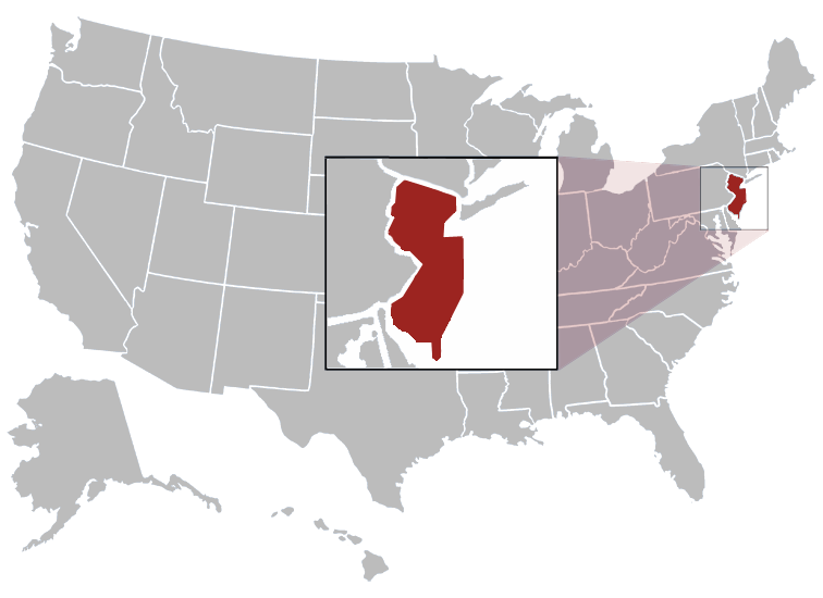 756×550 atlantic county map cities towns villages atlantic county from www.usacitymap.com
 474×320 map atlantic county sponsors from catcountry1073.com
 3533×2600 atlantic county nj wall map premium style marketmaps mapsales from www.mapsales.com
 250×184 atlantic county nj wall map premium style marketmaps from www.mapsales.com
 950×780 mold removal services atlantic county nj greenworks from greenworksllc.com
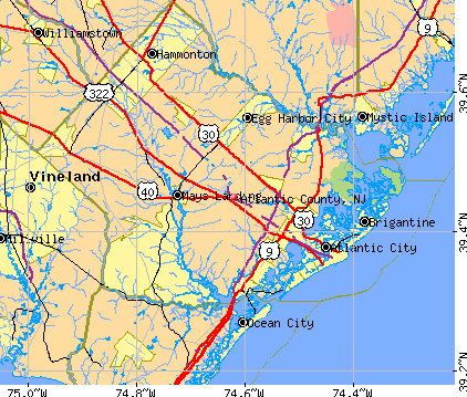 422×359 atlantic county jersey detailed profile houses real estate from www.city-data.com
 660×580 atlantic county jersey familypedia fandom from familypedia.wikia.org
 850×593 satellite map atlantic county from www.maphill.com
 600×436 atlantic county nj zip code wall map red style marketmaps from www.mapsales.com
 1910×1000 schools atlantic county nj niche from www.niche.com
 600×450 atlantic nj county wall map marketmaps mapsales from www.mapsales.com
 1910×1000 safe places atlantic county nj niche from www.niche.com
 712×563 click map atlantic county nj quiz mikenew from www.sporcle.com