
Buffalo Bayou, the slow-moving waterway that defines much of Houston, Texas, has a rich history and a revitalized present, reflected in the modern maps highlighting its trails, parks, and key landmarks. Understanding the map of Buffalo Bayou is key to experiencing its diverse offerings, from serene nature escapes to vibrant urban spaces.
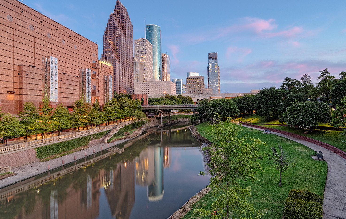
A typical map of Buffalo Bayou will depict the winding course of the bayou itself, starting from its origins west of the city and flowing eastward, eventually merging with the San Jacinto River and Galveston Bay. This longitudinal view illustrates the bayou’s journey through varied landscapes, showcasing the transition from lush, natural banks to concrete-lined channels within the urban core.
Key features prominently displayed on the map include Buffalo Bayou Park, a 160-acre urban green space that forms the heart of the bayou’s revitalization. The park’s walking and biking trails are meticulously mapped, allowing visitors to plan their routes and explore different sections. These trails, such as the popular Lost Lake Trail, connect various attractions, including Eleanor Tinsley Park, known for its open spaces and stunning downtown views.
Beyond the park, the map reveals other important landmarks. The Waugh Drive Bridge Bat Colony, a popular spot for evening bat-watching, is often marked, as is the Cistern, a former drinking water reservoir now repurposed as a unique art space. These points of interest highlight the bayou’s blend of natural and cultural attractions.
Maps often denote the location of kayak and canoe launch points along the bayou, facilitating recreational activities. Several companies offer guided tours and rentals, allowing visitors to experience the bayou from a unique perspective. The map also indicates areas suitable for fishing, another popular pastime along the waterway.
Beyond recreational uses, a comprehensive map can also show the infrastructure that supports the bayou’s function. Flood control measures, such as dams and retention basins, may be indicated, reflecting the bayou’s crucial role in managing stormwater runoff in the Houston area. This is particularly important in a city prone to heavy rainfall and flooding.
Modern maps of Buffalo Bayou increasingly incorporate interactive features, offering users the ability to zoom in on specific areas, view photos and videos, and access real-time information about trail closures or event schedules. These digital tools enhance the user experience and encourage exploration of this vital urban waterway.
In essence, a map of Buffalo Bayou is more than just a geographical guide; it’s a key to unlocking the diverse experiences the bayou offers, from tranquil nature walks to vibrant cultural attractions. It’s a testament to the ongoing efforts to preserve and enhance this natural resource for the benefit of the city and its residents.
 1474×934 buffalo bayou partnership from buffalobayou.org
  1200×670 home lockwood buffalo bayou from livingonbuffalobayou.com
  615×817 watershed maps save buffalo bayou from www.savebuffalobayou.org
  4804×2201 september save buffalo bayou from www.savebuffalobayou.org
  804×520 topographic map buffalo bayou project area save from www.savebuffalobayou.org
  1024×791 reducing flooding buffalo bayou save buffalo bayou from www.savebuffalobayou.org
  950×700 aerial buffalo bayou save buffalo bayou from www.savebuffalobayou.org
 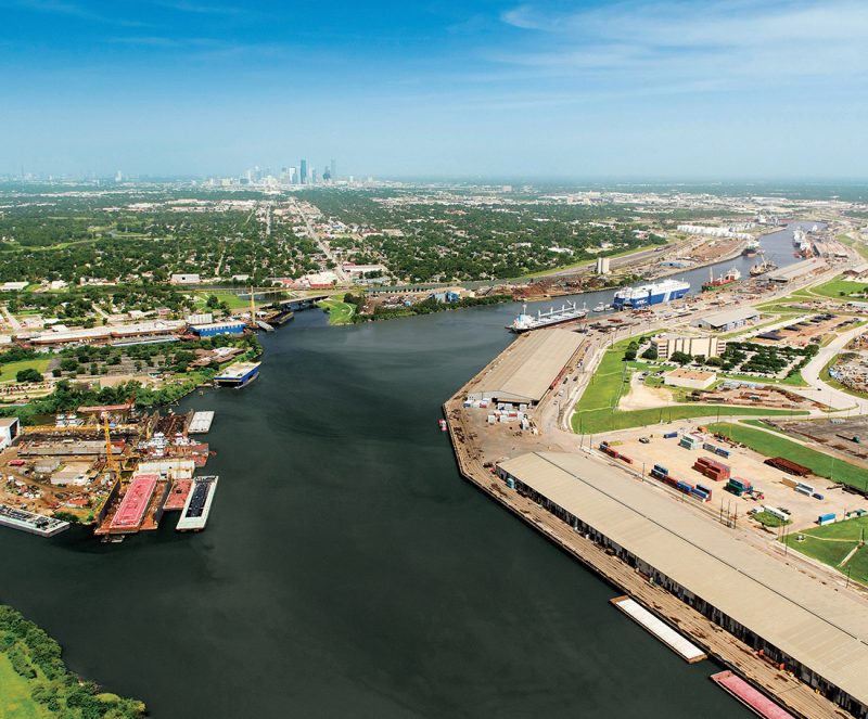 800×663 buffalo bayou east buffalo bayou partnership from buffalobayou.org
  1024×683 buffalo bayou east buffalo bayou partnershipbuffalo bayou partnership from v1.buffalobayou.org
  1706×1226 turning green space green bucks buffalo bayou save buffalo bayou from www.savebuffalobayou.org
  1308×866 buffalo bayou map from mungfali.com
  1000×1041 amenities lockwood buffalo bayou from livingonbuffalobayou.com
 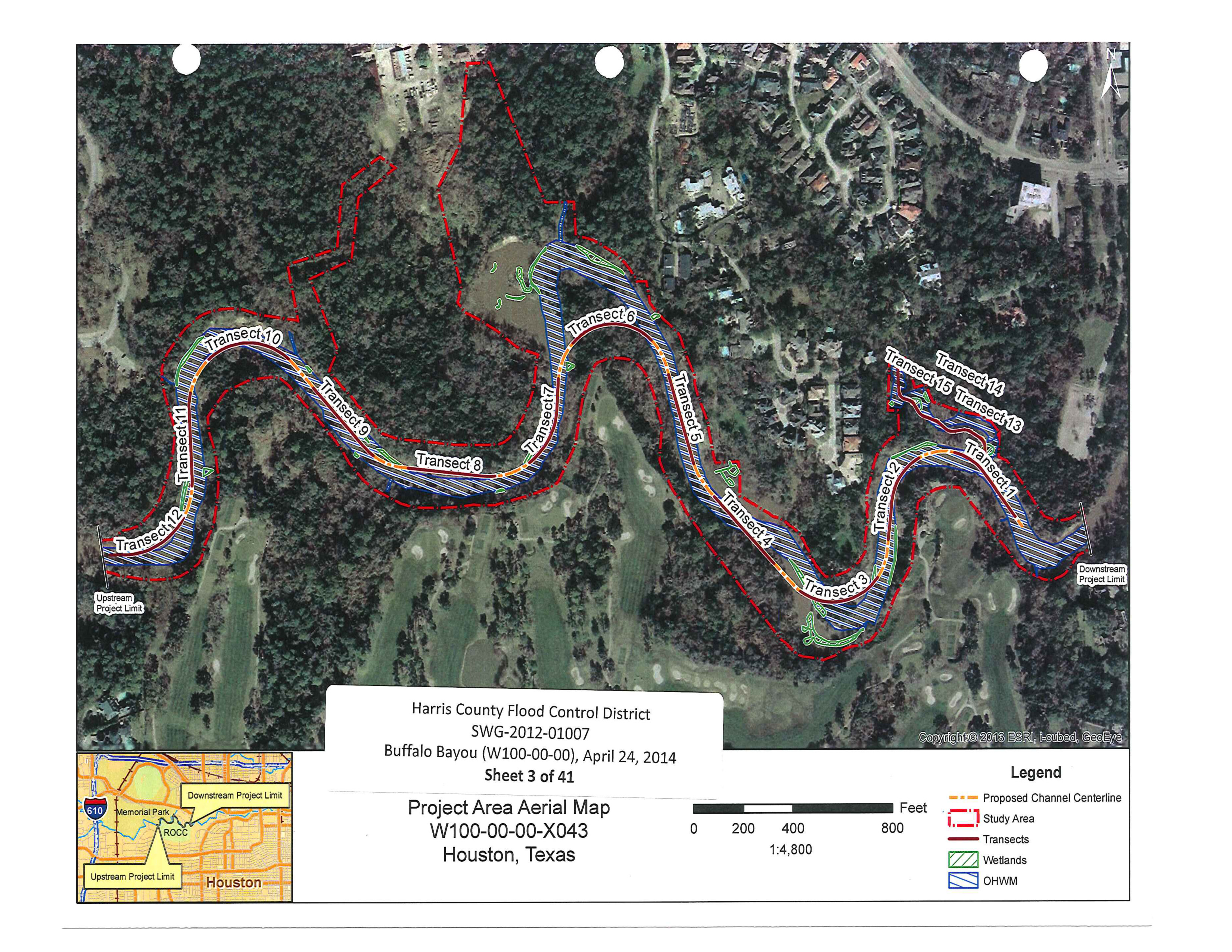 3300×2550 plans maps save buffalo bayou from www.savebuffalobayou.org
  1000×900 march save buffalo bayou from www.savebuffalobayou.org
  1024×1024 ecosystem save buffalo bayou from www.savebuffalobayou.org
  750×500 buffalo bayou alchetron social encyclopedia from alchetron.com
  1464×822 annual buffalo bayou partnership regatta presented gillman from buffalobayou.org
  1100×350 buffalo bayou park public art houston from publicarthouston.weebly.com
  1650×1210 buffalo bayou community plan houston stronger from houstonstronger.net
  736×2775 buffalo bayou park map bsewhm buffalo bayou park buffalo bayou bayou from www.pinterest.com
  4000×1548 buffalo bayou park trail map from mavink.com
  1300×999 buffalo bayou map res stock photography images alamy from www.alamy.com
  3000×3482 talkbuffalo bayou wikipedia from en.wikipedia.org
  930×594 buffalo bayou promenade scenario journal from scenariojournal.com
  2000×1000 buffalo bayou high network from network.thehighline.org
  250×293 buffalo bayou houston map map rose bowl from mapofrosebowl.blogspot.com