
Abilene, Kansas, a city steeped in history and small-town charm, offers a fascinating glimpse into the American West. A map of Abilene reveals a town strategically positioned along the I-70 corridor, making it easily accessible and a crucial stop for travelers. Understanding Abilene’s layout helps appreciate its historical development and present-day attractions. Historically, the Chisholm Trail significantly influenced Abilene’s growth. Map study shows how streets and areas followed the general direction of the Chisholm Trail. Cattle drives coming north through Kansas made Abilene a major livestock shipping point, a legacy reflected in the Chisholm Trail’s modern-day markers and memorials found throughout the city. The Eisenhower Presidential Library, Museum, and Boyhood Home are major points of interest easily located on any Abilene map. These sites, concentrated in a central area, offer an in-depth look into the life and career of President Dwight D. Eisenhower. The map shows that the Library and Museum are within walking distance of the downtown area, fostering a walkable, educational experience. Downtown Abilene, the city’s heart, appears on the map as a grid-like structure of streets, showcasing its planned development. A number of local businesses, restaurants, and shops line the streets, reflecting the community’s commitment to preserving its historic buildings and promoting local enterprise. The central location and organized layout of downtown make it a convenient place for both locals and visitors to access essential services and experience Abilene’s small-town atmosphere. Looking at a map also reveals Abilene’s parks and recreational areas. These green spaces provide opportunities for outdoor activities and relaxation. The city’s map reveals parks along the Smoky Hill River, offering scenic views and places for picnics, walking, and enjoying the natural environment. Beyond the core areas, a map of Abilene shows residential neighborhoods expanding outwards. These neighborhoods are typically well-maintained, offering a quiet and family-friendly environment. The map indicates the availability of schools, churches, and community centers within these residential areas, highlighting Abilene’s commitment to providing a good quality of life for its residents. Finally, considering Abilene’s location relative to other towns in Kansas is important. Positioned on I-70, Abilene benefits from its proximity to larger cities like Salina and Manhattan, providing access to a broader range of services and opportunities while maintaining its distinct identity. A map vividly demonstrates Abilene’s connectivity and its role as a regional hub within central Kansas. Thus, a map becomes not just a navigational tool, but a means to understand Abilene’s story and its role in the wider landscape.
 612×612 abilene kansas street map from www.landsat.com
 641×641 aerial photography map abilene ks kansas from www.landsat.com
 1421×1536 lh everts map abilene kansas art source international from artsourceinternational.com
 300×300 abilene ks from www.bestplaces.net
 1300×956 abilene kansas usa shown geography map road map stock photo alamy from www.alamy.com
 422×359 abilene kansas ks profile population maps real estate from www.city-data.com
 1600×1600 abilene kansas map poster modern home decor wall art print custom from mapmory.com
 761×1038 abilene road map from ontheworldmap.com
 800×968 abilene downtown map from ontheworldmap.com
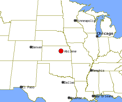 420×350 abilene profile abilene ks population crime map from www.idcide.com
 800×513 star parks recreation abilene kansas visit abilene kansas from abilenekansas.org
 680×510 tiny town kansas historic wonders place from familydestinationsguide.com
 1036×1390 abilene kansas map cut stock images pictures alamy from www.alamy.com
 648×345 moving abilene kansas btobers from www.btobers.com
 300×300 abilene zip ks from www.bestplaces.net
 1080×864 abilene ks restored map vintage city maps from www.vintagecitymaps.com
 264×264 places abilene kansas from www.bestplaces.net
 680×569 historic small town kansas states from familydestinationsguide.com
 1627×1120 map abilene city kansas from diaocthongthai.com
 500×659 abilene kansas wikipedia from en.wikipedia.org
 1028×1390 abilene kansas map united states america from www.alamy.com
 200×245 map abilene ks high res pastmaps from pastmaps.com
 2000×1300 abilene kansas map population history britannica from www.britannica.com
 800×441 abilene state park map from mavink.com
 3970×2726 helpful maps visit visit abilene kansas from abilenekansas.org
 947×513 map abilene ks kansas from townmapsusa.com