
Adak Island, part of the Aleutian Islands archipelago in Alaska, is a remote and rugged landmass with a fascinating history. A map of Adak reveals a landscape heavily shaped by volcanic activity and strategic military importance.
The island’s main features are its mountainous terrain, deep bays, and numerous lakes and streams. The central part of the island is dominated by the Adak Volcano, reaching a height of approximately 3,900 feet. While currently dormant, the volcano contributes to the island’s dramatic topography and fertile soil in some areas.
Andrew Lake, the largest freshwater lake on Adak, is a prominent feature on any map. It provides a crucial source of potable water for the island. Several other smaller lakes and ponds are scattered throughout the landscape, often nestled in valleys carved by glaciers. These water bodies contribute to the island’s unique ecosystem, supporting various bird and fish populations.
The coastline of Adak is heavily indented with bays and inlets. Kuluk Bay, on the northeast side, is a particularly large and significant bay. It historically served as a protected harbor for naval vessels during World War II and the Cold War. Sweeper Cove, another important inlet, is located near the former Adak Naval Air Station and provided vital logistical support. These bays are deep and provide excellent anchorages, though they can be subject to severe weather conditions.
Maps of Adak typically show the remnants of the former Adak Naval Air Station. The runway, control tower, and various buildings are still visible, albeit in varying states of disrepair. Roads, many now overgrown, connect the different parts of the former military base. The footprint of the base provides a stark reminder of the island’s past and its role as a strategic military outpost.
Beyond the former military infrastructure, a map of Adak also depicts the sparse distribution of the modern-day town of Adak. The town is primarily located near Kuluk Bay. Finding detailed maps showing individual streets and buildings within the town is possible, allowing exploration of the current residential areas, community facilities, and local businesses.
The topography influences the distribution of vegetation. Lower elevations tend to support grasslands and tundra vegetation. Higher elevations are often barren and rocky. Maps may indicate areas of limited tree growth, typically found in sheltered valleys. The lack of significant forest cover contributes to the island’s stark and windswept appearance.
Navigating Adak Island requires careful attention to maps and a good understanding of the terrain. Unmarked hazards, unpredictable weather, and limited infrastructure are considerations for anyone exploring the island. Detailed topographical maps are invaluable for hiking, hunting, and other outdoor activities.
 800×1164 adak island map maps winterbearcom from winterbear.com
  1600×834 map adak island from ansvers.com
  3542×2653 visit adak island trip reports winterbearcom from winterbear.com
  700×649 adak island from www.finelineboatplans.com
 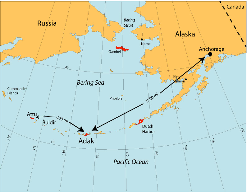 795×617 adak maps from franklinhaas.com
  474×478 adak from telephone.bouwman.com
  326×355 adak naval air facility from dec.alaska.gov
  640×640 map adak kagalaska islands showing caribou survey areas from www.researchgate.net
  352×352 adak island topographic map elevation relief from en-us.topographic-map.com
  700×759 adak island map caribou hunting caribou hunting from www.pinterest.com
  405×320 adak alaska area map from www.thedirectory.org
  600×371 adak bight adak island alaska tide station location guide from www.tide-forecast.com
  750×579 adak alaska map claire ryder blog from storage.googleapis.com
  1641×1873 map landing adak island harry truman from www.trumanlibrary.gov
  600×371 sweeper cove adak island alaska tide station location guide from www.tide-forecast.com
  1300×821 adak island bering sea colored elevation map stock photo from www.alamy.com
  850×628 map adak island alaska showing general location haven from www.researchgate.net
  600×371 andrew bay adak island alaska tide station location guide from www.tide-forecast.com
  640×640 map eastern portion adak island alaska showing location from www.researchgate.net
  600×371 clam lagoon kuluk bay adak island alaska tide station location guide from www.tide-forecast.com
  600×371 unalga bight adak island alaska tide station location guide from www.tide-forecast.com
  450×381 adak islands alaska from www.mapsofworld.com
  450×339 adak alaska alaska island map island from www.pinterest.com
  600×371 bay waterfalls adak island alaska tide station location guide from www.tide-forecast.com
  600×371 boot bay adak island alaska tide station location guide from www.tide-forecast.com
  1729×1454 adak island arm bay nautical chart noaa charts maps from geographic.org
  1000×600 adak maps aleut corporation from aleutcorp.com