
The year 1960 is often referred to as the “Year of Africa” due to the unprecedented number of African nations that gained independence from European colonial powers. The map of Africa in 1960 reflects this dramatic shift, showcasing both the burgeoning independence movements and the enduring presence of colonial empires. It’s a snapshot of a continent on the cusp of immense change, fraught with both hope and uncertainty.
Prior to 1960, much of Africa was divided into colonies and protectorates controlled by European powers like Great Britain, France, Portugal, Belgium, Spain, and Italy. The map displayed vast swathes of territory colored to represent these different imperial possessions. For example, much of West Africa was French territory (French West Africa), while large portions of East and Southern Africa were under British rule (British East Africa, Southern Rhodesia). The borders were often arbitrarily drawn by European administrators with little regard for existing ethnic or linguistic groups, a legacy that would contribute to future conflicts.
However, by 1960, the tide was turning. The weakening of European powers after World War II, coupled with the rise of nationalist movements within Africa, created a powerful impetus for decolonization. In that single year, 17 African nations achieved independence. These newly independent states, reflected on the 1960 map, included: Cameroon, Togo, Senegal, Mali, Madagascar, Somalia, Democratic Republic of the Congo (formerly Belgian Congo), Benin, Niger, Burkina Faso, Ivory Coast, Chad, Central African Republic, Republic of the Congo, Gabon, Nigeria, and Mauritania. The map started to show these nations with their own distinct boundaries, a symbolic break from the colonial past.
Examining the map closely reveals the patchwork nature of this transition. While some nations had already achieved independence, others remained firmly under colonial control. For instance, Algeria was still a French colony, embroiled in a bloody war for independence. Portuguese colonies like Angola and Mozambique were still years away from liberation, engaging in protracted armed struggles against Portuguese rule. Southern Rhodesia (present-day Zimbabwe) was still under white minority rule, reflecting the complexities of power dynamics in the region.
The political landscape of 1960 was further complicated by the Cold War. Both the United States and the Soviet Union sought to exert influence in the newly independent African nations, vying for strategic alliances and access to resources. This geopolitical struggle influenced the political trajectories of many African countries, with some aligning with the West and others with the East, leading to internal divisions and instability. The map of Africa in 1960, therefore, represents not only a continent emerging from colonialism but also a stage for the Cold War competition.
In conclusion, the map of Africa in 1960 is a powerful historical document. It visually represents the culmination of decades of colonial rule, the surge of African nationalism, and the dawn of a new era of independence. It’s a map of transition, showing a continent grappling with its past, navigating the complexities of the present, and looking towards an uncertain future. It serves as a reminder of the struggles for self-determination and the lasting impact of colonialism on the African continent.
 4410×4360 large detail administrative divisions map africa marks from www.mapsland.com
 700×777 map africa ce mid century history timemaps from timemaps.com
 3000×2250 map africa united states map from www.wvcwinterswijk.nl
 1300×1381 africa map res stock photography images alamy from www.alamy.com
 1080×1080 africa map vintage map africa administrative divisions from www.etsy.com
 1361×1789 africa wall map national geographic mapsales from www.mapsales.com
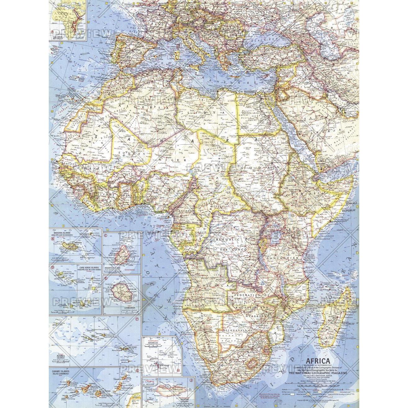 1314×1314 africa published national geographic map shop from www.mapshop.com
 3000×2250 map poster africa vintage print carte vintage etsy from www.etsy.com
 800×998 map africa africa vintage map wall map print vintage maps from www.vintage-maps-prints.com
 5000×5209 africa political map april comparison maps africa from www.reddit.com
 900×620 year africa ends historical atlas saharan africa from omniatlas.com
 1004×1390 political map africa res stock photography images alamy from www.alamy.com
 3000×2564 original map africa political architonic from www.architonic.com
 2562×2159 relief map africa retromaps from retromaps.bigcartel.com
 1280×1066 political map africa maps africa from retromaps.tumblr.com
 965×1390 africa administrative divisions map res stock photography from www.alamy.com
 875×914 map africa gustafmaps deviantart from www.deviantart.com
 900×620 year africa begins historical atlas saharan africa from omniatlas.com
 900×620 map africa circa united states map from wvcwinterswijk.nl
 500×375 original school political map africa wonderful from www.pinterest.com
 794×794 africa map vintage map africa administrative divisions history from www.etsy.com
 3051×3375 colonial infrastructure africa map map from www.deritszalkmaar.nl
 1280×1071 retromaps from retromaps.tumblr.com
 500×555 relief map africa retromaps images finder from www.aiophotoz.com
 1159×1500 redrawing map year africa magazine issuu from issuu.com
 1004×1390 political map africa ca stock photo alamy from www.alamy.com
 2048×1360 african independence map geocurrents from www.geocurrents.info
 575×596 retro year africa from sixtiesretro.blogspot.com
 640×636 hisatlas mapa de africa from www.euratlas.net
 590×581 drake memorial library year african independence from drakelibrary.blogspot.com
 7077×5237 mapping year african independence sounding maps from 3.143.160.160