The map of Africa in 1960 looked dramatically different from the modern one. It was a period of intense transition, witnessing the dismantling of colonial empires and the rise of newly independent nations. While the seeds of Pan-Africanism had been sown decades earlier, 1960 became the “Year of Africa,” with a wave of independence movements sweeping across the continent.
Prior to 1960, most of Africa was carved into colonies and protectorates controlled by European powers. France dominated West and Equatorial Africa, with vast territories like French West Africa (comprising modern-day Senegal, Mali, Ivory Coast, etc.) and French Equatorial Africa (including Gabon, Congo-Brazzaville, and Chad). The United Kingdom held significant sway in East and Southern Africa, controlling countries like Nigeria, Ghana (formerly Gold Coast, independent since 1957), Kenya, Uganda, Tanganyika (later Tanzania), and Southern Rhodesia (later Zimbabwe, though still under white minority rule). Belgium controlled the vast and resource-rich Belgian Congo (later the Democratic Republic of the Congo). Portugal held onto its colonies of Angola, Mozambique, Guinea-Bissau, and Cape Verde. Spain had a smaller presence with territories like Spanish Sahara (Western Sahara) and Spanish Guinea (Equatorial Guinea).
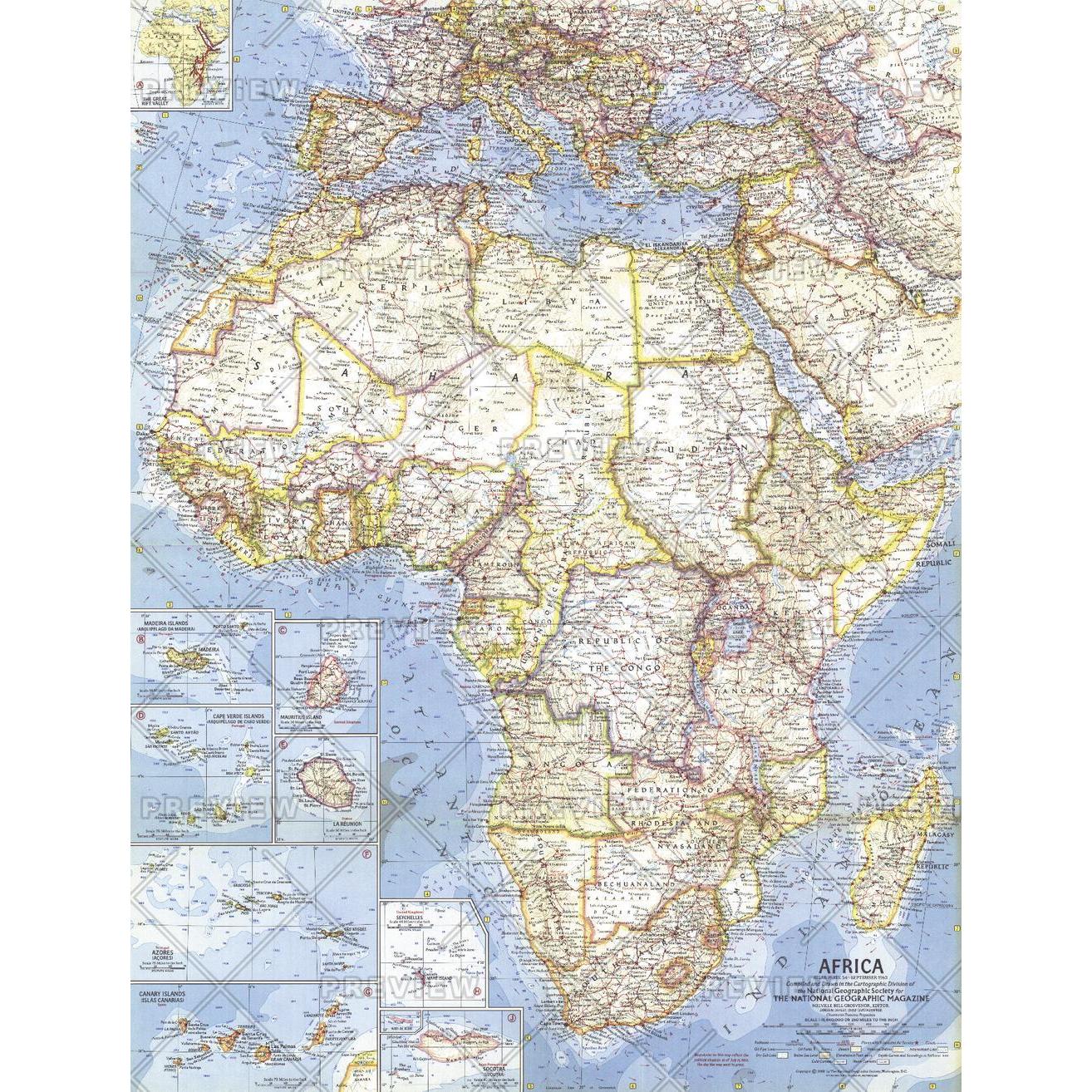
The most striking feature of the 1960 map was the prevalence of these European names and administrative divisions. Borders were often arbitrarily drawn with little regard for ethnic, linguistic, or cultural boundaries, a legacy that continues to contribute to political instability in some regions today. These colonial borders frequently cut through tribal lands, creating tensions that would later erupt into conflicts.
The year 1960 saw a seismic shift in this landscape. Countries like Nigeria, Senegal, Ivory Coast, Cameroon, Togo, Benin (Dahomey), Niger, Burkina Faso (Upper Volta), Chad, Central African Republic, Congo-Brazzaville, Democratic Republic of the Congo (Congo-Kinshasa), Gabon, Somalia, and Madagascar all gained their independence. Each new nation faced the monumental task of building its own identity, institutions, and economies while navigating the complexities of the Cold War and post-colonial relationships with their former rulers.
However, the transition wasn’t always peaceful or complete. Algeria, still a French colony in 1960, was embroiled in a bloody war for independence. Southern Rhodesia remained under the control of a white minority government, denying the majority black population their rights. South Africa continued to enforce its apartheid regime, a system of racial segregation and discrimination. Portuguese colonies like Angola and Mozambique were gearing up for long and arduous liberation struggles.
The map of Africa in 1960, therefore, represented a moment of hope and potential, yet also a reminder of the enduring legacies of colonialism. While many nations celebrated their newfound sovereignty, the challenges of nation-building, economic development, and social cohesion remained immense. The seeds of future conflicts and collaborations were sown in this pivotal year, shaping the course of the continent for decades to come.