
Pennsylvania boasts a diverse network of airports, ranging from large international hubs to smaller regional and general aviation facilities. Mapping these airports reveals the state’s commitment to air travel and its strategic location within the Northeast. Philadelphia International Airport (PHL) stands as the state’s largest and busiest airport. Located near Philadelphia, it serves as a major gateway for both domestic and international flights. It’s a primary hub for American Airlines and connects Pennsylvania to destinations across the globe. Its significance is visually prominent on any airport map. Pittsburgh International Airport (PIT), another major airport, serves the western part of the state. While not as large as PHL, PIT offers a significant number of domestic flights and some international routes. The airport has undergone significant modernization and is known for its innovative technology. Beyond these two behemoths, a network of regional airports connects smaller cities and towns across Pennsylvania. Harrisburg International Airport (MDT), located near the state capital, provides regional air service and handles cargo operations. Lehigh Valley International Airport (ABE) in Allentown serves the eastern part of the state, including the Lehigh Valley region. Erie International Airport/Tom Ridge Field (ERI) provides air travel options for northwestern Pennsylvania. Smaller regional airports like Wilkes-Barre/Scranton International Airport (AVP) and University Park Airport (SCE) near State College are crucial for connecting more remote areas of the state. These airports offer a lifeline for business travelers, students, and residents who need access to air transportation. General aviation airports are even more numerous and scattered throughout Pennsylvania. These airports primarily serve private pilots, charter flights, and flight training. Examples include Lancaster Airport (LNS), Reading Regional Airport (RDG), and many smaller municipal airports. They are essential for local economies and provide a vital service for businesses and individuals who rely on private air travel. Mapping these airports reveals not only their locations but also patterns of air travel and economic activity. The concentration of airports near major cities highlights the importance of air travel for business and tourism. The presence of smaller regional airports shows the commitment to connecting rural areas and providing access to air transportation for all Pennsylvanians. The existence of numerous general aviation airports underscore the popularity of private flying in the state. Pennsylvania’s diverse geography and varied economic activities necessitate a well-developed and accessible air transportation system, effectively portrayed by a detailed airport map. Regularly updated maps are vital, as airports expand, renovate, or sometimes, unfortunately, close, reflecting changing needs and economic landscapes. Examining the distribution and types of airports provides a comprehensive view of Pennsylvania’s air travel infrastructure and its significance to the state’s economy and connectivity.
 800×489 airports pennsylvania pennsylvania airports map from www.mapsofworld.com
  1159×628 airports pennsylvania map from letstalksport.co.uk
  1024×768 pennsylvania map airports from www.lahistoriaconmapas.com
 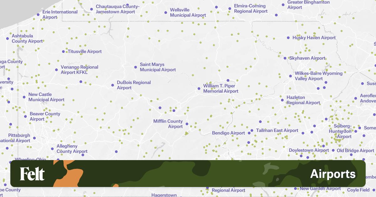 1200×630 airports pennsylvania from felt.com
  723×526 pennsylvania airports map top airports pennsylvania from worldmapwithcountries.net
  774×496 newsletters center rural pa from www.rural.pa.gov
  1200×910 philadelphia airport map explore philadelphia airport map from www.pinterest.com
  730×510 philadelphia international airport map pennsylvania from www.mapsofworld.com
  1000×716 airport terminal map philadelphia airport mapjpg from www.aviationexplorer.com
  1400×958 philadelphia phl international airport pennsylvania code map from airportix.com
  1200×698 map philadelphia airport airport map philadelphia pennsylvania usa from maps-philadelphia.com
  768×394 philadelphia international airport phl map code parking from www.airfleetrating.com
  1604×1077 philadelphia international airport map phl airport map from www.way.com
  720×790 philadelphia airportphl terminal maps shops restaurants food court from www.tripindicator.com
  1913×1291 navigating philadelphias airports comprehensive guide terminal from moragacamap.github.io
  2377×1617 philadelphia international airport map from ontheworldmap.com
  450×303 map philadelphia airport phl orientation maps phl from www.philadelphia-phl.airports-guides.com
 .png) 930×658 pittsburgh international airport world travel guide from www.worldtravelguide.net
930×658 pittsburgh international airport world travel guide from www.worldtravelguide.net  2048×2048 philadelphia airport map guide phls terminals from www.ifly.com
  730×510 erie international airport map pennsylvania mapsofworld from www.mapsofworld.com
  730×510 pittsburgh international airport map pennsylvania from www.mapsofworld.com
  730×510 harrisburg international airport map pennsylvania from www.mapsofworld.com
  1200×932 phl airport map map phl airport pennsylvania usa from maps-philadelphia.com
  600×371 philadelphia international airport location guide from www.weather-forecast.com
  1024×777 map airports printable map from mapofusprintable.com
  768×402 biggest airports pennsylvania traveling base from travelingbase.com
  1200×795 philadelphia airport terminal map philadelphia terminal map from maps-philadelphia.com
  800×559 airports map airports usa from www.mapsofworld.com
  1018×720 map airports images www from www.kodeposid.com
  696×364 pennsylvania airports maps from letstalksport.co.uk