
A map showing Alabama, Mississippi, and Louisiana reveals a fascinating tapestry of geography, history, and culture interwoven across the American South. Geographically, the dominant feature is the Gulf Coastal Plain, a low-lying expanse gradually rising inland. This plain heavily influences the river systems, including the mighty Mississippi River, which forms Louisiana’s eastern border with Mississippi and serves as a vital transportation artery.
The terrain varies across the three states. Alabama, the easternmost, boasts rolling hills and forests in its northern reaches, transitioning to the coastal plain in the south. Mississippi is characterized by its fertile delta region along the Mississippi River, contributing significantly to its agricultural output historically. Louisiana, with its proximity to the Gulf of Mexico, is marked by extensive wetlands, bayous, and coastal marshes.
When examining a map of the area, pay close attention to the numerous rivers. Besides the Mississippi, notable waterways include the Alabama River, the Tombigbee River (both converging in Alabama to form the Mobile River), and the Pearl River, which defines a portion of the Mississippi-Louisiana border. These rivers have shaped settlement patterns, agricultural practices, and transportation networks for centuries.
Key cities are strategically located. New Orleans, Louisiana, sits at the mouth of the Mississippi River, a historic port city renowned for its unique culture. Baton Rouge, the capital of Louisiana, lies upriver. Jackson serves as the capital of Mississippi, situated inland. Montgomery, Alabama, is located in the central part of the state and functions as Alabama’s capital. Mobile, Alabama, is another important port city along the Gulf Coast.
Historically, this region holds profound significance. The map reflects the legacy of Native American nations, early European colonization (French and Spanish influence is particularly evident in Louisiana), the plantation economy reliant on enslaved labor, and the Civil Rights Movement. Place names often echo this complex past.
A modern map also highlights transportation infrastructure – interstate highways connecting major cities, airports facilitating national and international travel, and ports handling cargo. Economic activity is often clustered around these transportation hubs.
Furthermore, observing land use patterns reveals much about the region. Forests dominate large swathes of Alabama and Mississippi. Agricultural areas are prominent in the Mississippi Delta and parts of Louisiana. Coastal areas are dedicated to fishing, shrimping, and tourism. The map also indicates areas dedicated to national forests, wildlife refuges, and other protected lands.
In essence, a map of Alabama, Mississippi, and Louisiana is a window into a region rich in natural resources, shaped by a complex history, and continuously evolving within the context of the modern United States. Each state, while sharing a common geographical base and a thread of Southern identity, possesses unique characteristics visible through careful map interpretation.
 1536×1142 map louisiana mississippi alabama constructed latest from archive.org
 1600×1430 alabama louisiana mississippi united states stock vector from www.dreamstime.com
 3500×2795 historical city parish state maps louisiana from mapgeeks.org
 1041×800 map louisiana mississippi alabama norman leventhal map from collections.leventhalmap.org
 2900×2300 map louisiana mississippi alabama finley from theantiquarium.com
 1536×1092 map louisiana mississippi alabama david rumsey historical map from www.davidrumsey.com
 809×635 contentdm from bplonline.contentdm.oclc.org
 380×274 map louisiana mississippi alabama florida united states map from wvcwinterswijk.nl
 2449×2000 historic state map alabama mississippi louisiana arkansas grigg from mapsofthepast.com
 474×437 map louisiana mississippi ontheworldmapcom from ontheworldmap.com
 592×420 alabama mississippi louisiana from help.rockware.com
 793×880 map alabama mississippi tennessee from ontheworldmap.com
 600×470 north america sheet xiii parts louisiana arkansas mississippi from www.geographicus.com
 768×627 map alabama mississippi louisiana atlas united from www.antipodean.com
 1666×1200 original map tennessee kentucky alabama mississippi from fity.club
 875×1390 usa alabama mississippi louisiana arkansaschesapeake baynew orleans from www.alamy.com
 1536×1241 map states louisiana mississippi alabama philadelphia from archive.org
 2481×2000 historic state map louisiana mississippi alabama finley from mapsofthepast.com
 474×263 map louisiana gulf coast united states map from wvcwinterswijk.nl
 1583×1158 map south carolina georgia florida alabama mississippi from www.pinterest.com
 638×600 louisiana arkansas mississippi alabama from duvalfamily.net
 724×800 map tennessee mississippi latest map update from mapspainandportugal.github.io
 2048×1578 map louisiana alabama map vrogueco from www.vrogue.co
 1246×1600 mississippi valley mississippi arkansas tennessee alabama louisiana from www.antiquemapsandprints.com
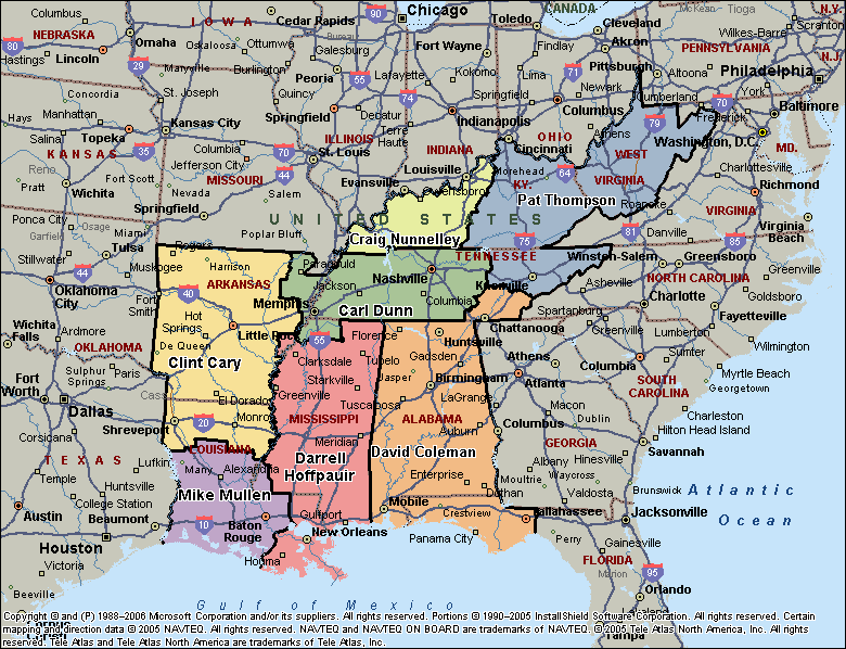 780×598 map louisiana alabama map from deritszalkmaar.nl
 1500×1237 map southern states circa including florida louisiana from www.pinterest.com
 1042×800 post route map states alabama mississippi adjacent from collections.leventhalmap.org
 500×400 barness geography tennessee alabama mississippi louisiana ark from sandtique-rare-printsandmaps.com
 1522×2000 map georgia florida alabama mississippi tennessee engraved from library.missouri.edu