
An Alabama zip code map is a visual representation of the state, divided into geographic regions defined by zip codes. Zip codes, short for Zone Improvement Plan codes, are numerical postal codes used by the United States Postal Service (USPS) to streamline mail delivery. Understanding the Alabama zip code map can be helpful for a variety of reasons, from identifying areas with specific demographics to planning logistical operations.
Alabama’s zip codes generally fall within the 350-369 range. They’re organized sequentially, roughly from north to south and west to east, although there are exceptions due to factors like population density and postal routes. Metropolitan areas like Birmingham, Huntsville, Montgomery, and Mobile have numerous zip codes within relatively small geographic areas, reflecting the higher concentration of residences and businesses. Rural areas, on the other hand, typically encompass larger geographic areas with fewer zip codes.
A typical Alabama zip code map will show the five-digit zip codes as boundaries within the state. Some maps also include the zip+4 codes, which add four digits to the end of the five-digit code and further pinpoint the location within a zip code block. These more precise codes are often used by businesses for direct mail marketing and targeted advertising.
The usefulness of an Alabama zip code map extends beyond simply locating an address. Businesses can use zip code data for market research, sales territory alignment, and targeted advertising campaigns. By analyzing the demographic information associated with different zip codes, companies can better understand their customer base and tailor their marketing efforts accordingly. For example, a business looking to open a new retail location might use zip code data to identify areas with a high concentration of their target demographic.
Real estate professionals also find zip code maps invaluable. They can use them to understand the boundaries of different neighborhoods, assess property values in specific areas, and identify trends in the housing market. A real estate agent might use a zip code map to show a potential buyer the different neighborhoods that fall within their desired price range.
Government agencies and non-profit organizations utilize zip code maps for various purposes, including resource allocation, disaster planning, and community outreach. By understanding the geographic distribution of the population, these organizations can better allocate resources and deliver services to those in need. For instance, during a natural disaster, emergency responders can use zip code maps to identify areas most affected and coordinate relief efforts.
Several online resources provide interactive Alabama zip code maps. These maps often allow users to search for specific zip codes, view demographic data, and even measure distances between different locations. Some maps integrate with mapping platforms like Google Maps, offering a more detailed view of the geographic area.
In conclusion, the Alabama zip code map is a versatile tool that provides valuable insights into the state’s geographic divisions. From businesses conducting market research to individuals searching for a new home, understanding the Alabama zip code map can be beneficial for a wide range of purposes. Its ability to geographically organize and visualize demographic data makes it an indispensable resource for anyone seeking to understand the diverse landscape of Alabama.
 863×1513 zip code map alabama map from deritszalkmaar.nl
 546×818 alabama digit zip code vector map vector mapscom from your-vector-maps.com
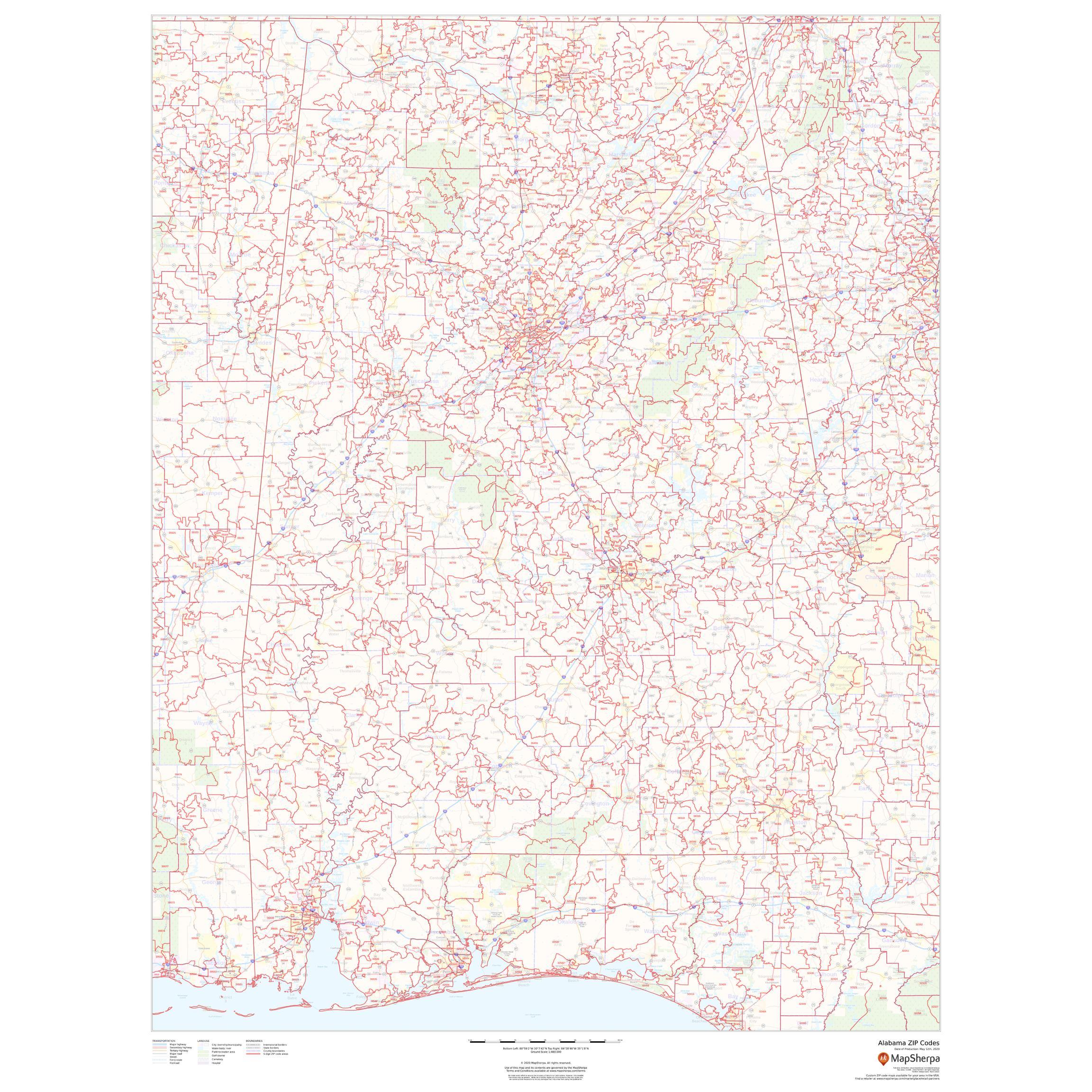 2304×2304 alabama zip code map map sherpa map shop from www.mapshop.com
 252×220 alabama simple zip code map vector mapscom from your-vector-maps.com
 1640×2613 cities alabama zip codes dorothy dennis blog from exodtwjvs.blob.core.windows.net
 378×582 digit zip code map from www.gotomylist.com
 200×201 editable alabama map cities roads counties zip codes from digital-vector-maps.com
 800×1116 zip codes list alabama alabama zip code map from www.mapsofindia.com
 461×600 alabama zip code wall map basic style marketmaps mapsales from www.mapsales.com
 450×600 alabama zip code wall map mapscomcom from www.maps.com
 452×600 alabama zip code wall map basic style marketmaps from www.mapsales.com
 298×386 zip code alabama fill printable fillable blank pdffiller from www.pdffiller.com
 448×275 complete list alabama zip code full zip code alabama genguide from genguide.com.ng
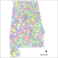 200×201 editable alabama map counties zip codes illustrator from digital-vector-maps.com
 769×576 alabama zip codes county lanny rivera blog from storage.googleapis.com
 0 x 0 alabama zip code map excel zip codes list population map youtube from www.youtube.com
 700×700 alabama zip code map counties standard stanfords from www.stanfords.co.uk
 800×1135 alabama zip code map alabama zip code from www.mapsofworld.com
 461×600 alabama zip code wall map red style marketmaps mapsales from www.mapsales.com
 800×1067 huntsville alabama zip code map oconto county plat map from ocontocountyplatmap.blogspot.com
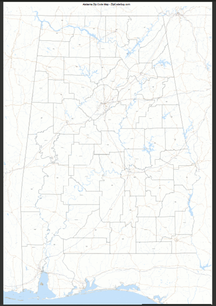 424×600 alabama zip code map alabama mappery from www.mappery.com
 769×1025 zip codes alabama map from letstalksport.co.uk
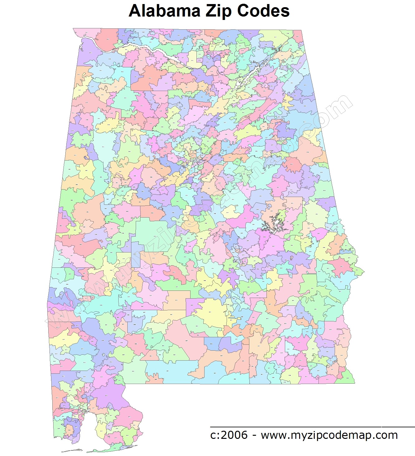 1333×1463 alabama zip code maps alabama zip code maps from www.myzipcodemap.com
 309×450 alabama map zip codes counties amazonca from www.amazon.ca
 1024×1593 alabama zip codes list mae kimbrell blog from storage.googleapis.com
 515×653 alabama zip code zipdatamaps blog from zipdatamaps.com
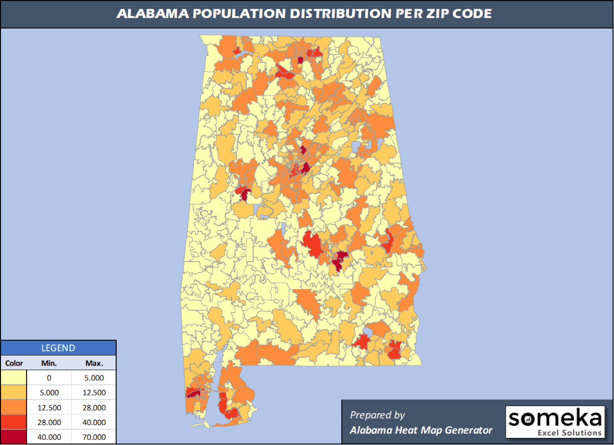 1200×870 alabama zip code map population list excel from www.someka.net
 800×1189 alabama county zip codes map from www.mapsofindia.com
 4608×3309 zip code map alabama guide finding alabama from neebishislandmichiganmap.pages.dev
 816×1056 sample maps from shanepowell2003.tripod.com
 877×1363 zip code map alabama from letstalksport.co.uk
 383×609 county zip code maps alabama deliverymaps from www.deliverymaps.com
 470×393 alabama digit zip code vector map printable vector maps from your-vector-maps.com