
Ambergris Caye, Belize’s largest island, boasts a vibrant blend of natural beauty and laid-back Caribbean charm. A map of Ambergris Caye reveals a long, narrow island oriented north-south, stretching approximately 25 miles in length and about a mile wide in most places.
The heart of the island and where most tourist activity concentrates is San Pedro Town, located roughly midway down the eastern coast. Maps clearly highlight its dense concentration of hotels, restaurants, bars, and shops clustered along the beach and Front Street (Barrier Reef Drive). Understanding San Pedro’s layout is crucial for navigation, with “south” and “north” being the primary directional references. Side streets branch westward, away from the beach, offering a mix of residential areas and businesses.
North and south of San Pedro, the island becomes more sparsely populated, transitioning to resorts, private homes, and stretches of undeveloped coastline. A map illustrates the increasing distance between establishments as one ventures away from the town center. Travel beyond San Pedro typically involves golf carts, the most common mode of transportation, or boats, which are essential for accessing the western side of the island.
The western side of Ambergris Caye, facing the mainland, is characterized by lagoons, mangrove forests, and secluded beaches. A map emphasizes the intricate network of waterways and the limited road access compared to the eastern coast. Exploring this side often requires a boat tour, offering opportunities for birdwatching, fishing, and observing the island’s diverse ecosystem.
Crucially, a map of Ambergris Caye highlights the Belize Barrier Reef, located just offshore along the eastern coast. The reef is the island’s defining feature, attracting divers and snorkelers from around the world. The Hol Chan Marine Reserve and Shark Ray Alley, two popular snorkeling and diving sites, are prominently marked on most maps, indicating their location relative to San Pedro. The proximity of the reef is what protects the eastern shore from strong waves, offering calm waters for swimming and other water activities.
Detailed maps often include information on specific dive sites, fishing spots, and other points of interest. These might indicate locations of specific restaurants, resorts, or even smaller attractions like the Secret Beach, a popular spot on the western coast known for its shallow, turquoise waters. They also show the location of the island’s airstrip, just south of San Pedro, the main point of entry for most visitors arriving by air.
In summary, a map of Ambergris Caye is an invaluable tool for planning your trip. It reveals the layout of San Pedro Town, the distribution of development along the coast, the intricate waterways of the western side, and, most importantly, the proximity of the world-renowned Belize Barrier Reef. Understanding these features allows visitors to navigate the island effectively and make the most of their time in this tropical paradise.
 700×929 printable map ambergris caye belize from mungfali.com
 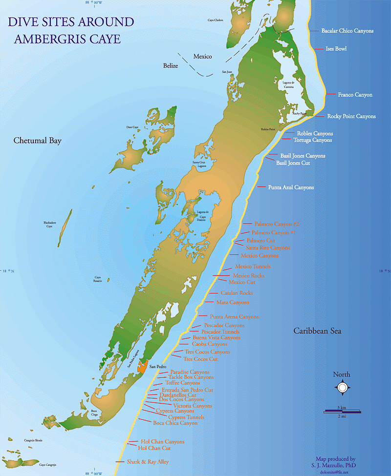 800×975 belize maps ambergris caye san pedro caribbean central american maps from ambergriscaye.com
  1300×1390 map ambergris caye island belize geography outlines from www.alamy.com
  1388×2102 map ambergris caye belize from www.w2n.net
  530×696 ambergris caye belize map jean caldwell blog from storage.googleapis.com
  600×600 leonardo dicaprio builds eco resort ambergris caye belize message from ambergriscaye.com
  667×982 belize maps map ambergris caye belize belizean area from ambergriscaye.com
  474×613 belize maps ambergris caye san pedro caribbean central american from www.pinterest.de
  549×728 people coming enjoy west side ambergris from www.sanpedroscoop.com
  495×356 ambergris caye map start planning trip from www.scuba-diving-smiles.com
  2000×3500 ambergris caye tourist map from mungfali.com
  800×600 ambergris caye belize vacation from ar.inspiredpencil.com
  1050×1437 map belize ambergris caye from www.pinterest.com
  2000×1869 scuba diving ambergris caye belize san pedro forum tripadvisor from tripadvisor.com
  1561×2469 ambergris caye tourist map discover beauty belize from www.pinterest.com
  400×630 map ambergris caye places die pinterest from www.pinterest.com
  474×730 caribbean fish card ambergris caye belize frankos maps from www.pinterest.com
  653×766 map ambergris caye northern belize sites scientific from www.researchgate.net
 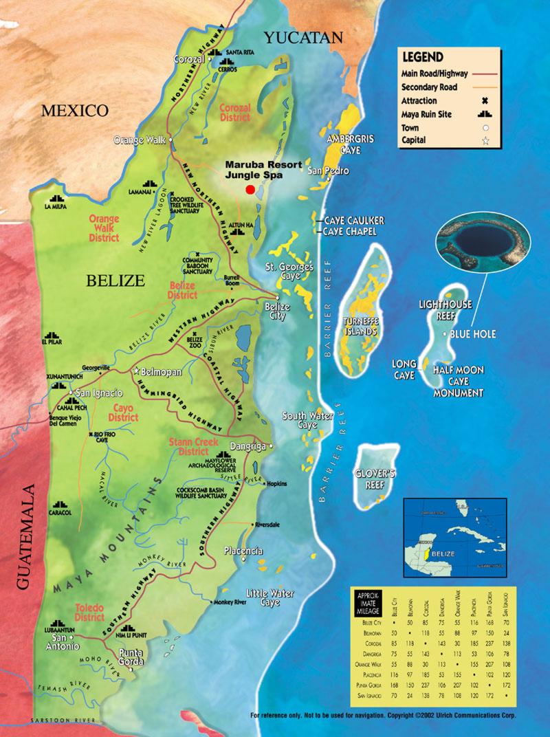 800×1072 popular images map belize from verpoim.blogspot.com
  488×675 map belize ambergris caye turneffe atoll lighthouse reef great from www.pinterest.com
  700×1073 ambergris caye dive map reef creatures identification guide from ambergriscaye.com
  720×1147 map ambergris caye belize world map from www.nicocastricum.nl
  474×798 click larger version map belize from www.pinterest.com
  600×665 scuba sites ambergris caye belize ambergris caye belize punta from www.pinterest.com
 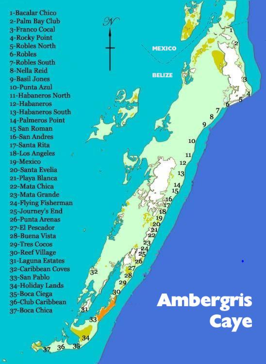 548×749 san pedro ambergris caye belize safe size map adventures from ambergriscayecartsbelize.com
  803×1045 ambergris caye guide from www.thewolverineden.com
  500×602 ambergris caye snorkeling close access barrier reef from www.tropicalsnorkeling.com
  600×665 pin ben moody quick saves caribbean travel belize bacalar from www.pinterest.com
  600×1150 san pedro town belize maps ambergris caye from ambergriscaye.com