
The Old Testament unfolds within a specific geographical context: the Ancient Near East. Understanding the geography of this region is crucial for grasping the historical, political, and cultural narratives of the Hebrew Bible.
Key Regions and Civilizations
The fertile crescent, a crescent-shaped area spanning from Mesopotamia through the Levant and into Egypt, is the primary stage for many Old Testament events.
- Mesopotamia: Located between the Tigris and Euphrates rivers, Mesopotamia was home to powerful empires like Sumer, Akkad, Babylon, and Assyria. Ur, Abraham’s birthplace, was a prominent Sumerian city. Babylon, under rulers like Hammurabi and later Nebuchadnezzar, features prominently in stories of the exile. Assyria, known for its military prowess, conquered the northern kingdom of Israel.
- The Levant: This coastal region along the eastern Mediterranean Sea includes modern-day Israel, Palestine, Lebanon, Syria, and Jordan. The land of Canaan, promised to Abraham and his descendants, occupies a central part of the Levant. Key cities include Jerusalem, Jericho, Samaria, and Damascus. The Philistines, fierce rivals of the Israelites, controlled the coastal plains.
- Egypt: Situated along the Nile River, Egypt was a powerful kingdom with a rich culture and advanced civilization. The Old Testament features the Israelites’ enslavement in Egypt, the Exodus led by Moses, and frequent interactions between Egypt and the kingdoms of Israel and Judah.
Significant Geographical Features
Beyond these key regions, several geographical features influenced events in the Old Testament:
- The Jordan River: This river runs through the Jordan Valley and empties into the Dead Sea. It served as a natural border and was the site of important events like the crossing into the Promised Land.
- The Dead Sea: A hypersaline lake with no outlet, the Dead Sea is the lowest point on earth. It is associated with the destruction of Sodom and Gomorrah.
- Mount Sinai: Located in the Sinai Peninsula, this mountain is where Moses received the Ten Commandments.
- Trade Routes: Major trade routes, like the King’s Highway, crossed the Levant, connecting Egypt and Mesopotamia. Control over these routes was strategically important and led to frequent conflicts.
Impact on the Old Testament Narrative
The geographical context significantly shaped the political and religious landscape of the Old Testament. The constant interactions and conflicts between the Israelites and their neighbors (Egyptians, Assyrians, Babylonians, Philistines, etc.) influenced their identity, beliefs, and worldview. The land itself was not just a backdrop, but a promised inheritance, a source of sustenance, and a symbol of God’s covenant with his people. Understanding the map of the Ancient Near East helps to illuminate the complex historical and cultural forces that shaped the Old Testament narratives.
 801×599 ancient east enter bible from enterthebible.org
  2048×1536 ancient east map world map from www.aarushijains.com
  503×369 ancient east from www.thirdwell.org
 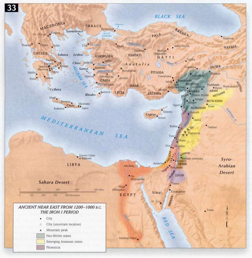 1024×1048 bible atlas from www.seektheoldpaths.com
  600×372 abingdon bible land map ancient east exodus cokesbury from www.cokesbury.com
  1645×1132 image ancient east map circa bc ian mladjovjpg israel from he.israelunited.wikia.com
 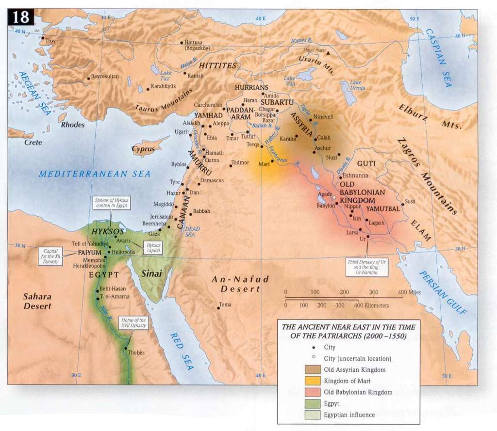 1024×889 bible maps precept austin from www.preceptaustin.org
  1000×666 map world testament bible history from bible-history.com
  3000×2250 bible maps from www.knowingthebible.net
 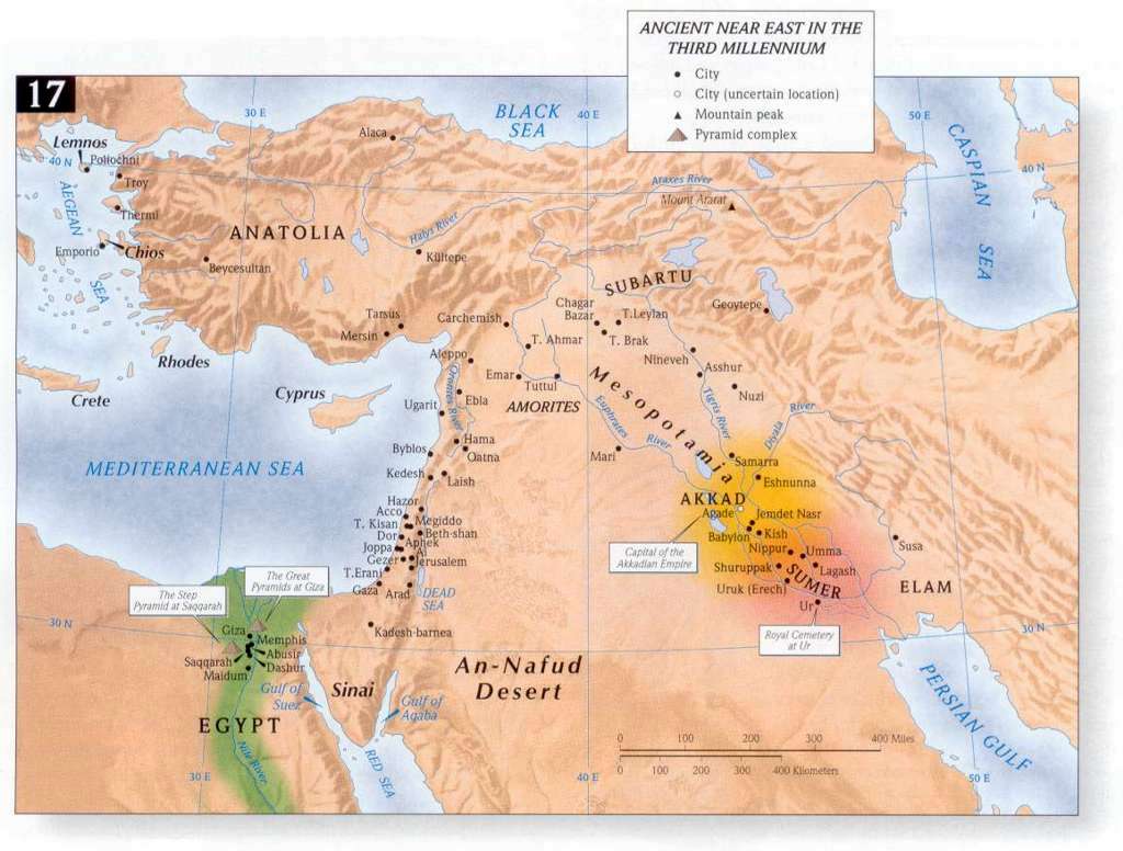 1024×776 ancient east bc christian library from www.christianstudylibrary.org
  1000×708 pin getty maps ancient east babylon map ancient maps from www.pinterest.com
  700×640 map east time genesis from www.pinterest.com
 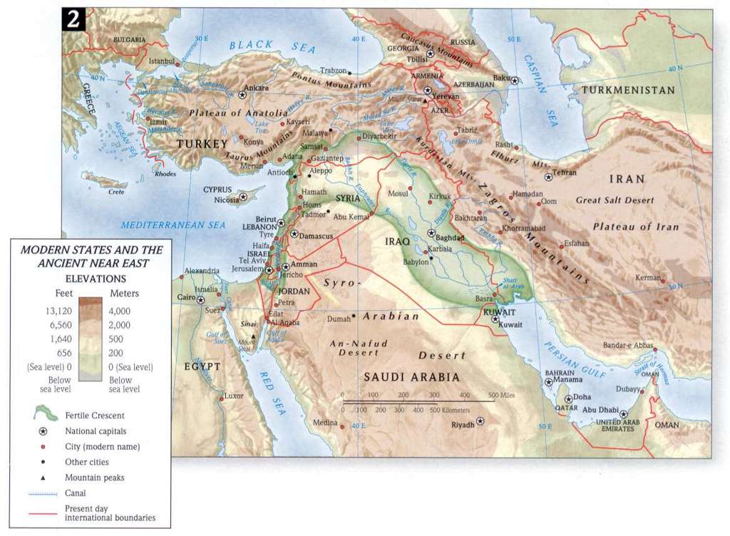 1024×752 testament maps yale bible study from yalebiblestudy.org
  851×511 encountering testament edition esources baker from bakerpublishinggroup.com
  601×456 map ancient east biblical from learningdblegalise.z21.web.core.windows.net
  724×1024 testamentmaps fmc world from fmcworld.net
  1200×627 ancient east bce illustration world history from www.worldhistory.org
  474×672 map land israel testament times bible history from bible-history.com
  436×404 ancient east history maps studycom from study.com
  1024×776 testament survey map ancient east exam placeregion from quizlet.com
  1980×660 ancient east time abraham bcresourcesnet from bcresources.net
  449×500 testament map history from www.israel-a-history-of.com
  720×582 ancient map location jesse lyles blog from storage.googleapis.com
  481×420 ancient east empires map map ancient maps bible history from www.pinterest.com
  474×333 eastern archaeology international association assyriology from iaassyriology.com
  1200×1099 ancient east site maps institute study ancient cultures from oi.uchicago.edu
  600×600 physical map ancient east carta jerusalem from store.carta-jerusalem.com
  599×511 map ancient east bible history from bible-history.com
  2118×1448 ancient east map nancy valerie from audrieyceleste.pages.dev
 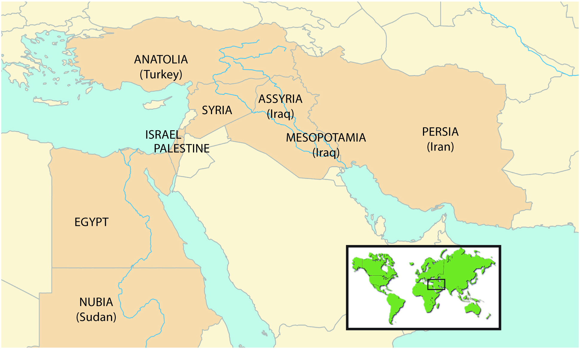 1939×1168 ancient east map labeled from learningdblegalise.z21.web.core.windows.net
  1300×936 east ancient map stock photo alamy from www.alamy.com
  750×484 ancient east cradle civilization smarthistory from smarthistory.org
  2351×1672 ancient east cradle civilization from smarthistory.org