
The Ausable River, located in the Adirondack Mountains of New York State, boasts two main branches: the East Branch and the West Branch. Consequently, a map of the Ausable River is essentially a representation of these two major tributaries and their extensive network of smaller streams, lakes, and surrounding terrain.
Key Features Displayed on Maps:
- River Course: The most prominent feature is, of course, the precise route of the East and West Branches. Maps detail their origins, meanders, and confluences. The East Branch generally flows from the southeast, originating near Dix Mountain, while the West Branch begins further west, near Lake Placid.
- Tributaries: Numerous smaller creeks and streams feed into the main branches. These tributaries are vital to the river’s ecosystem and are often named and labeled on detailed maps. Expect to see brooks like John’s Brook, Marcy Brook, and numerous unnamed waterways depicted.
- Elevation and Topography: Given the mountainous terrain, topographic maps are particularly useful. Contour lines illustrate changes in elevation, showing steep slopes, valleys, and the overall ruggedness of the landscape. Shaded relief maps are also helpful, providing a visual representation of the terrain.
- Lakes and Ponds: The Ausable River watershed contains various lakes and ponds. Maps typically identify larger water bodies such as Upper Ausable Lake and Lower Ausable Lake, as well as smaller ponds scattered throughout the area.
- Infrastructure: Roads, bridges, trails, dams, and settlements are usually marked on maps. These features are essential for navigation, access to recreational areas, and understanding the human impact on the river system. Maps may also show locations of campgrounds, fishing access points, and hiking trailheads.
- Land Use and Cover: Maps sometimes indicate land use, such as forested areas, wetlands, agricultural land, and urban areas. This information provides context for understanding the river’s water quality and overall health.
Types of Maps Available:
- Topographic Maps: Offered by the USGS (United States Geological Survey), these maps are invaluable for showing elevation and detailed terrain.
- Recreational Maps: Focus on features of interest to hikers, anglers, and paddlers. They often highlight trails, campsites, fishing spots, and put-in/take-out locations for canoes and kayaks.
- Fishing Maps: Specifically designed for anglers, these maps may include information on fish species, stocking locations, and access points.
- Online Interactive Maps: Websites like Google Maps and specialized mapping platforms provide interactive maps of the Ausable River, often with satellite imagery and customizable layers.
Uses of an Ausable River Map:
- Navigation: For hikers, paddlers, and anglers, maps are essential for navigating the river and surrounding trails.
- Planning: Maps help plan outdoor activities, such as hiking routes, fishing trips, or paddling expeditions.
- Conservation: Scientists and conservationists use maps to study the river’s ecosystem, monitor water quality, and develop strategies for protecting the watershed.
- Education: Maps are valuable tools for learning about the geography, ecology, and history of the Ausable River region.
Ultimately, a comprehensive map of the Ausable River provides a vital resource for anyone interested in exploring, understanding, or protecting this significant Adirondack waterway.
 1920×1080 ausable river oscoda michigan from oscoda.com
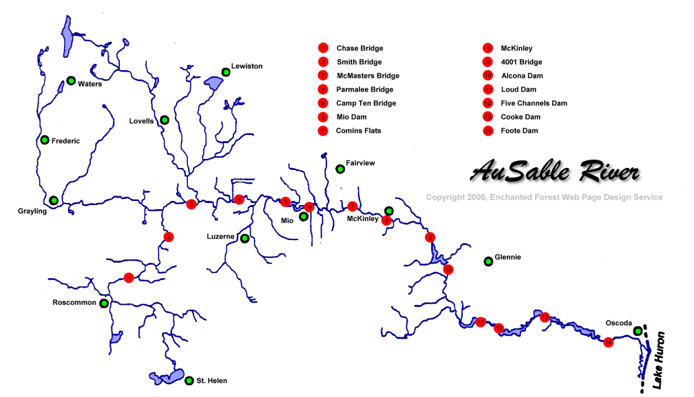 1008×577 ausable river dams map from mavink.com
 1276×621 ausable river map from www.lahistoriaconmapas.com
 1500×2250 map guidebook au sable river wild water maps goodreads from www.goodreads.com
 618×1024 yorks west branch ausable river pickpockets dream dark skies from darkskiesflyfishing.com
 1194×526 au sable river map map worksheets from www.haasjuwelier.nl
 880×1075 youve adirondack maps meet artist draws from wskg.org
 1024×791 au sable river michigan map map from deritszalkmaar.nl
 1024×657 au sable river threat action from www.pinterest.com
 650×1350 west branch ausable river map nys dept environmental conservation from www.dec.ny.gov
 1000×653 guide fly fishing north branch au sable river from guiderecommended.com
 524×323 au sable river depth chart from ethanparkin.z21.web.core.windows.net
 474×435 au sable river michigan great rivers anglers great from www.pinterest.com
 315×450 ausable river york updated from www.tripadvisor.ca
 500×500 au sable river michigan fishing report from www.whackingfatties.com
 1800×1301 piracy ausable ausable freshwater center from www.ausableriver.org
 1000×409 day river michigan blue magazine from www.mibluemag.com
 1670×1288 fiberglass manifesto gates au sable lodge au sable river stream from thefiberglassmanifesto.blogspot.com
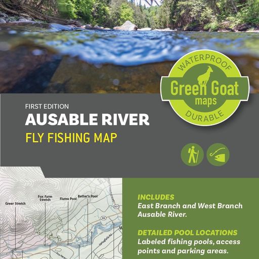 512×512 au sable river map alexia lorraine from beitrisoevvy.pages.dev
 800×384 ausable river maps canoe kayak kayaking canoe from www.pinterest.com
 1872×1152 ausable river canoeing map from www.pinterest.com
 1138×1472 riverwalk ausable chasm adirondacks ny from www.ausablechasm.com
 469×116 ausable river maps canoeing oscoda river from www.pinterest.com
 850×570 map ausable river basin scientific diagram from www.researchgate.net
 640×260 race map ausable river canoe marathon canoe race courses from www.pinterest.com
 474×825 au sable river fishing report michigan fishing kayak trip fly fishing from www.pinterest.com
 1000×239 map trips rates borchers ausable river canoe kayak grayling from www.canoeborchers.com
 550×943 carlisle canoe livery ausable river guide grayling mi from www.carlislecanoelivery.com
 800×744 diy guide fly fishing west branch ausable river york from diyflyfishing.com
 768×287 au sable river public access from ausableaccess.com
 768×756 diy guide fly fishing au sable river michigan diy fly fishing from diyflyfishing.com
 430×140 ausable river tubing map alexia lorraine from beitrisoevvy.pages.dev
 350×350 au sable river michigan facts kids from kids.kiddle.co
 439×429 map ausable river west branch york white water adirondak from www.riverfacts.com
 2122×1640 au sable river michigan map secretmuseum from www.secretmuseum.net