
The Australian Outback, a term conjuring images of red dust, endless horizons, and resilient wildlife, is a captivating yet challenging landscape. Understanding its geography requires more than just a simple political map; it demands a grasp of its ecological zones, sparse settlements, and crucial landmarks. A map of the Australian Outback, therefore, becomes a guide to survival and a key to unlocking its secrets.
Geographically, the Outback encompasses a huge swathe of the continent, primarily in Western Australia, South Australia, the Northern Territory, and parts of Queensland and New South Wales. It’s not a single, homogenous region but a collection of diverse environments. The iconic red deserts, like the Simpson Desert and the Great Victoria Desert, dominate large areas. These regions are characterized by sand dunes, gibber plains (stony deserts), and spinifex grasslands.
Significant landmarks punctuate the seemingly endless landscape. Uluru (Ayers Rock), a massive sandstone monolith, is a sacred site for Aboriginal Australians and a globally recognized symbol of the Outback. The MacDonnell Ranges in the Northern Territory offer dramatic gorges, waterholes, and hiking trails. Lake Eyre, in South Australia, is a vast salt lake that occasionally fills with water after significant rainfall, transforming the arid landscape into a vibrant wetland.
Human settlement in the Outback is sparse and often concentrated around mining towns, cattle stations (ranches), and Aboriginal communities. Key towns like Alice Springs in the Northern Territory and Broken Hill in New South Wales serve as vital supply hubs, providing services and support to the surrounding areas. Mapping these settlements reveals the lifelines that connect this vast region, highlighting the importance of infrastructure for transportation, communication, and resource management.
A useful Outback map will also depict the extensive network of unsealed roads and tracks, often the only means of access to remote areas. These roads, like the Gunbarrel Highway and the Tanami Track, require careful planning and robust vehicles due to their challenging conditions. Knowing their location and condition is crucial for safe travel.
Furthermore, environmental factors are vital to understanding the Outback. A map showing water sources, such as bores (drilled wells) and natural springs, can be critical for survival. Rainfall patterns, usually scarce and unpredictable, influence vegetation distribution and animal populations. Understanding these patterns is essential for managing grazing lands and protecting fragile ecosystems.
In conclusion, a comprehensive map of the Australian Outback is more than just a representation of geographical locations. It is a tool that reflects the region’s ecological diversity, human settlement patterns, infrastructure challenges, and the essential relationship between the land and its inhabitants. It is a roadmap to understanding the resilience and beauty of this unique and often misunderstood corner of the world.
 474×266 outback australia map australian outback map australia from maps-australia.com
  1700×1550 outback australia map from mungfali.com
  500×469 australian outback map from www.outback-australia-travel-secrets.com
  729×661 outback australia north south graphics goholi from www.australia4wheeldriverentals.com
  733×544 left soul outback australia frugal frolicker from frugalfrolicker.com
  1700×1550 outback map south australia travel vrogueco from www.vrogue.co
  1047×1280 outback central south australia cartographics map from www.mapworld.com.au
  1600×1256 australia map outback scene stock photo ekays from depositphotos.com
  1500×1197 australia map outback country view inserted stock illustration from www.shutterstock.com
  1050×700 outback maps recommend from traveloutbackaustralia.com
  549×412 australian outback travel guide outback australia from www.outback-australia-travel-secrets.com
  839×733 australia outback map ats vrogueco from www.vrogue.co
  1000×1000 outback map from fity.club
  767×711 forkorte rog loop australian outback map vedlaegge venskab from crowndistilleries.com
  1116×754 outback map golden outback lifestyle businesses australia from fity.club
 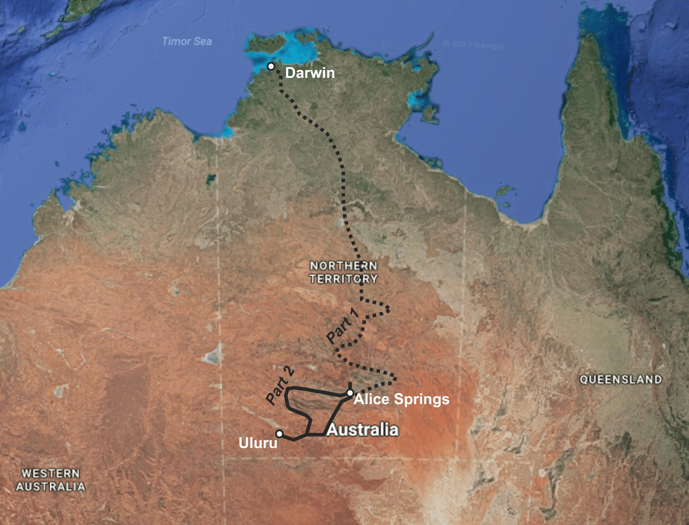 2290×1746 capturing australias outback part exploring earth from exploringtheearth.com
 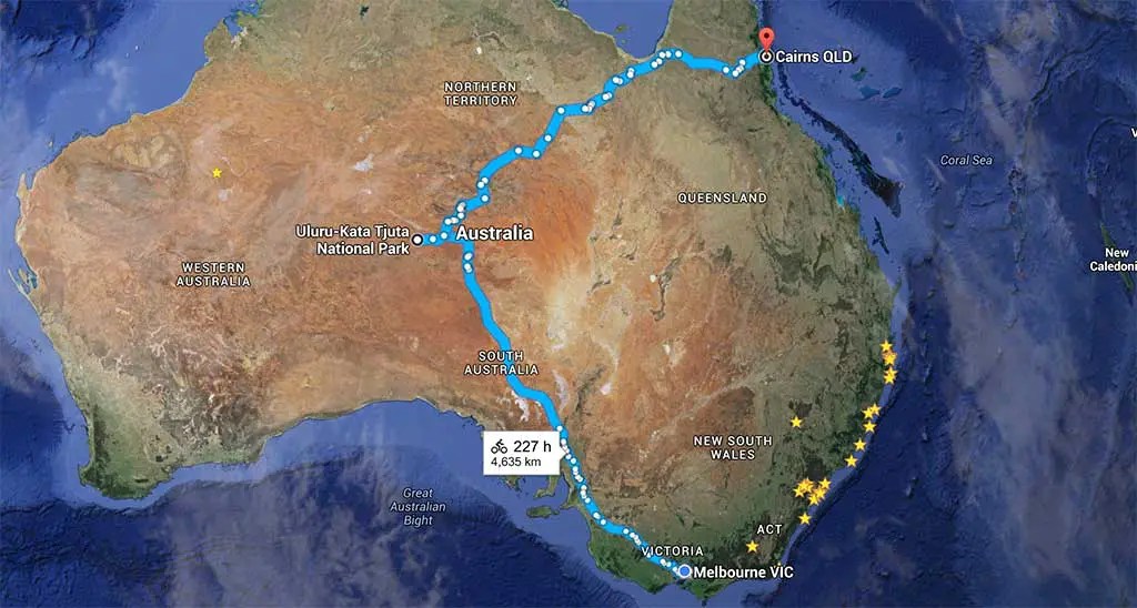 1024×548 biking australian outback halfway from www.halfwayanywhere.com
  800×804 outback turtledove fandom powered wikia from turtledove.wikia.com
 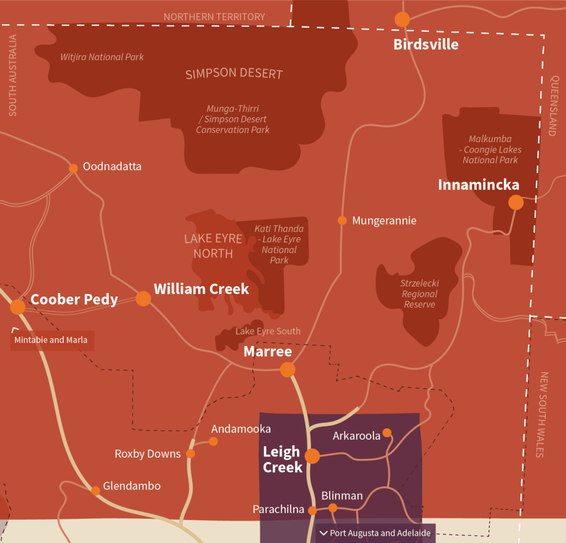 1100×1055 outback south australia from flindersandoutback.com.au
  1000×1000 australias outback globally important from theconversation.com
  2048×1536 map outback loop south australia woof media from woofmedia.com.au
  510×270 outback australia map mods rbeamng from www.reddit.com
  1271×1034 map australia mazahjornaldomsn from mazahjornaldomsn.blogspot.com
  800×1080 queenslands outback trail outback aussie tours from outbackaussietours.com.au
  736×552 route map ultimate outback air adventure illustrated map from www.pinterest.com.au
  2200×1470 australian outback tours travel adventure tours australia from www.adventuretours.com.au
  474×266 outback australia start west australian from thewest.com.au
  1832×1080 australian outback map ats from www.modland.net
  821×800 australian outback pictures from www.wisegeek.com