
Baltimore, Maryland, is a city defined by its diverse and distinct neighborhoods. Understanding the city requires grasping the nuances of each area, and a good map is essential. The Map of Baltimore Neighborhoods is more than just a geographical tool; it’s a key to unlocking the city’s history, culture, and character.
The city is often divided into larger regions, such as North Baltimore, South Baltimore, East Baltimore, and West Baltimore. Within these regions lie a mosaic of smaller, tightly-knit communities, each with its own identity. For example, North Baltimore boasts affluent neighborhoods like Roland Park and Guilford, known for their beautiful architecture and manicured lawns. Contrastingly, areas within East Baltimore, such as Greektown, retain a strong ethnic heritage reflected in their businesses and community events.
South Baltimore, once a hub for industry, now blends its working-class roots with new development. Neighborhoods like Federal Hill offer stunning harbor views and a lively bar scene, while Locust Point retains its maritime charm. The redevelopment of areas like Port Covington has further altered the landscape, adding modern structures and attracting new residents.
West Baltimore presents a different narrative, marked by challenges and resilience. Historic neighborhoods like Sandtown-Winchester have faced economic hardship, but also possess a strong sense of community and cultural pride. The map here can be crucial for understanding resource allocation and identifying areas needing revitalization.
A detailed map of Baltimore neighborhoods will not only show geographical boundaries, but also often indicates landmarks, points of interest, and even prevalent businesses. This helps to understand the unique character of each area. For instance, a map might highlight the artistic vibe of Station North, indicated by the presence of galleries and theaters. Or it might point to the Inner Harbor, the city’s central tourist destination, surrounded by neighborhoods like Downtown and Harbor East, known for their upscale hotels and restaurants.
It’s important to note that the boundaries of Baltimore neighborhoods can sometimes be fluid and debated. What one resident considers “Charles Village,” another might call “Remington.” This ambiguity is part of the city’s charm and reflects the organic growth of these communities. However, a reliable map, often maintained by city planning offices or community organizations, provides a generally accepted framework.
Beyond navigation, the Map of Baltimore Neighborhoods serves as a vital tool for understanding demographics, housing patterns, and socioeconomic factors. Researchers, policymakers, and community organizers use these maps to analyze trends, identify needs, and implement strategies for improvement. Understanding the spatial distribution of resources and challenges is crucial for addressing inequality and promoting equitable development.
In conclusion, the Map of Baltimore Neighborhoods is far more than just lines on a page. It’s a visual representation of the city’s complex social fabric, a historical record, and a crucial tool for understanding and shaping its future. By studying the map, one gains a deeper appreciation for the diversity, resilience, and unique character of Baltimore and its many distinct communities.
 3090×3500 filebaltimore neighborhoods mappng from commons.wikimedia.org
  640×775 map baltimore neighborhoods from ansvers.com
  846×1080 administrative map city baltimore vector image from www.vectorstock.com
  1142×1390 modern city map baltimore maryland city usa neighborhoods from www.alamy.com
  1024×933 detailed map baltimore city from mavink.com
  5100×6600 neighborhood health profile reports baltimore city health department from health.baltimorecity.gov
  2048×1024 baltimore neighborhood map from hoodmaps.com
  1152×1390 baltimore neighborhoods stock vector images alamy from www.alamy.com
  1536×1536 baltimore neighborhood map gis geography from gisgeography.com
  2560×1969 large baltimore maps print high resolution from www.orangesmile.com
  1024×729 baltimore city neighborhood maps visit baltimore from baltimore.org
  850×963 wealth baltimore hunting maryland md page from www.city-data.com
  700×793 baltimore wikitravel from wikitravel.org
  636×899 filebaltimore neighborhoods mapsvg wikitravel shared from wikitravel.org
  526×543 howdy hon june from howdyhon.blogspot.com
  646×646 maplive baltimore nonprofit organization from www.pinterest.com
  930×863 favorite baltimore area neighborhoods from www.yaffeteam.com
 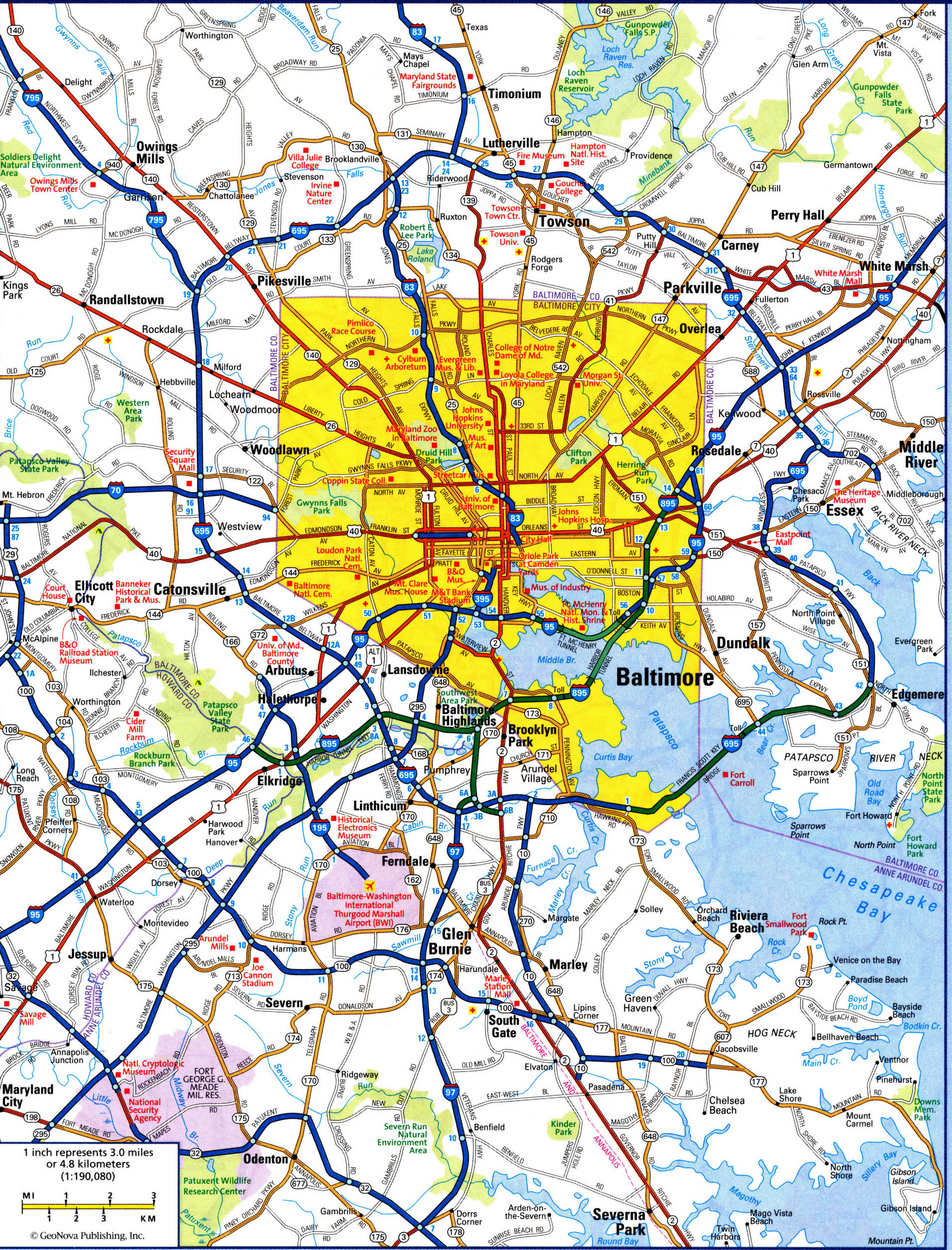 1915×2514 baltimore md city map detailed map roads baltimore from us-atlas.com
  792×1008 baltimore city neighborhood maps visit baltimore vrogueco from www.vrogue.co
  1536×1152 building codes baltimore city june brian blog from storage.googleapis.com
  1512×1512 baltimore neighborhood map baltimore map art poster native maps from nativemaps.us
  1000×800 baltimore city street map print vintage poster map art from gallerythane.com
  3000×3883 impact vacancy baltimores neighborhoods bnia baltimore from dev.bniajfi.org
 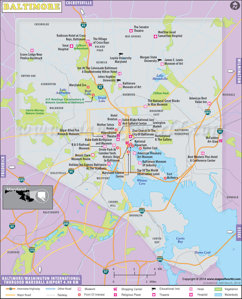 800×989 baltimore map map baltimore city maryland from www.mapsofworld.com
  800×532 drilling baltimores neighborhoods abell foundation from abell.org
  736×1087 baltimore neighborhood map black white yellow lettering from br.pinterest.com
  2560×1820 bad neighborhoods baltimore map mary greenwell blog from storage.googleapis.com
  963×542 map shows gentrification baltimores neighborhoods from www.pinterest.com
  1080×1326 baltimore neighborhoods year map from www.reddit.com
  1300×1180 antique map baltimore res stock photography images alamy from www.alamy.com
  3672×4752 population data census bnia baltimore neighborhood from bniajfi.org