
Exploring Almuñécar, Spain: A Guide to its Charm Through the Map Almuñécar, a captivating coastal town nestled in the Granada province of Spain, boasts a rich history and stunning natural beauty. Understanding its layout through a map is key to unlocking its charm and maximizing your visit. The map reveals that Almuñécar is geographically defined by its dramatic coastline, punctuated by rocky headlands, sandy beaches, and the iconic Peñón del Santo, a large rock crowned with a cross, dividing the town’s main beaches. Playa de San Cristóbal, the longest beach, stretches west of the Peñón, offering ample space for sunbathing and watersports. To the east lies Playa Puerta del Mar, closer to the town center, providing easy access to shops and restaurants. Navigating the town itself, the map highlights the importance of the N-340 coastal highway, the main artery connecting Almuñécar to other coastal towns like Nerja and Motril. From this highway, smaller roads wind down into the heart of the town, revealing a labyrinthine network of streets perfect for exploration. The historical center, clustered around the imposing Castillo de San Miguel (Almuñécar Castle), is a maze of narrow, winding streets, often pedestrianized. Here, the map helps you pinpoint key historical landmarks, like the Roman aqueduct remains, scattered throughout the old town. The Cueva de Siete Palacios, now an archaeological museum, is also a must-see, marked on most tourist maps. The map also reveals the importance of the town’s squares or “plazas.” Plaza de la Constitución, the main square, is the heart of Almuñécar, bustling with activity and surrounded by cafes and shops. Other notable plazas, often tucked away in the old town, offer quieter retreats. Beyond the immediate town center, the map illustrates the more modern developments spreading along the coast and into the surrounding hills. The Punta de la Mona peninsula, jutting out to the east, features luxurious villas and apartments, as well as a marina. To the west, the map shows the growing residential areas extending along Playa de San Cristóbal. For those interested in nature, the map indicates the proximity of the Sierra Nevada mountain range, providing a stunning backdrop to the town. While the mountains themselves are a drive away, their presence influences the climate and landscape. Additionally, the map reveals nearby natural areas, such as the Río Verde valley, ideal for hiking and exploring the Andalusian countryside. Finally, consulting a map beforehand allows you to strategically plan your visit, considering factors like accommodation location in relation to beaches, restaurants, and attractions. Knowing the general layout allows for spontaneous exploration, confident in your ability to navigate back to your starting point or discover hidden gems along the way. A map of Almuñécar is more than just a guide; it’s your key to unlocking the treasures of this captivating Spanish town.
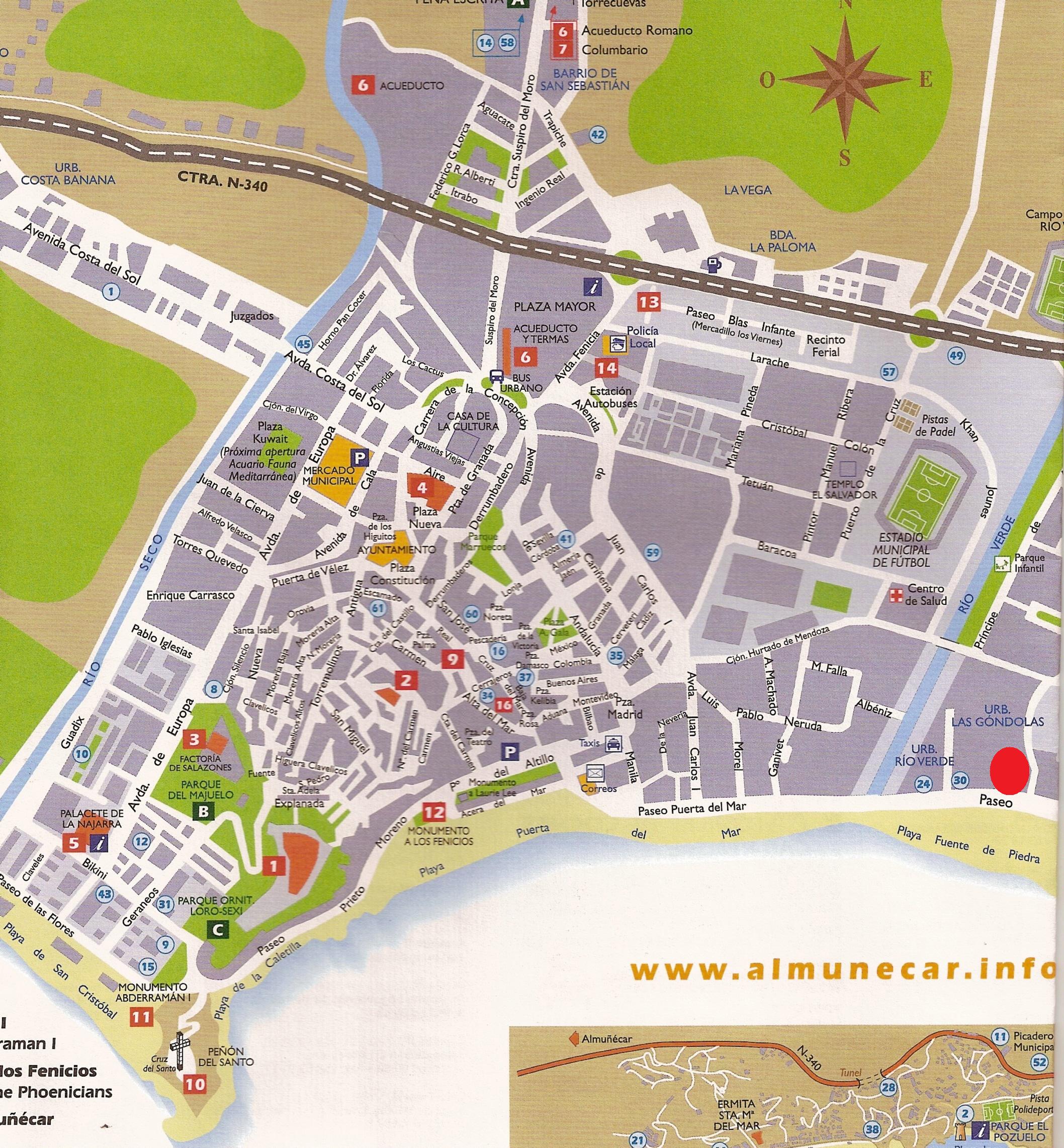 2116×2283 almunecar map almunecar spain mappery from www.mappery.com
  1737×1268 townhouse rent almunecar andalucia spain area from www.myspanishhouse.com
  600×371 almunecar spain map from mavink.com
  480×320 maps costa tropical spain andalucia granada visit from www.costatropical.net
  1307×951 turistkarta almunecarse from almunecar.se
  1080×1259 almunecar top almunecar travel almunecar from www.beachtravelwine.com
  600×348 map almunecar map planning holiday almunecar granada spain from www.spain-map.com
  554×386 almunecar mapa mapa from coiffurefemmefrun.blogspot.com
  460×287 almunecar maps costa tropical villages province granada from www.andalucia.com
  600×371 almunecar tide station location guide from www.tide-forecast.com
  350×246 almunecar street map from www.carspain.com
 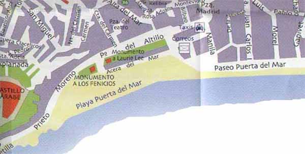 600×304 almunecar map almunecar from www.spain-map.com
  313×500 almunecar spain city map jason patrick bates goodreads from www.goodreads.com
  1300×1065 map focus city almunecar holiday concept stock from www.alamy.com
  2367×1633 tha viajealmunecar from ceres.ugr.es
  333×302 townhouse rent almunecar andalucia spain map area from www.myspanishhouse.com
  535×258 holiday almunecar spanish holiday home holiday southern spain from haveagreatholiday.com
  1021×540 sexi neighborhoods almunecar almunecar info from almunecarinfo.com
  720×420 top fun quiet charming beaches almunecar from www.lovegranada.com
  600×371 guide urbain de almunecar from fr.weather-forecast.com
  800×450 bussresa costa tropical almunecar dagar from www.rokebuss.se
  850×524 political map almunecar from www.maphill.com
  1060×507 donde esta almunecar espana mapa almunecar donde esta la ciudad from dondeesta.net
  800×461 visiter almunecar andalousie top des activites faire from levoyageauthentique.com
  543×199 landkarte von almunecar andalusien reisefuhrer from www.competa-online.de
  514×238 almunecar spain complete resource visit move from almunecarinfo.com