
Map of the Alps in Italy: A Geographical Overview The Italian Alps, a majestic section of the larger Alpine range, form a stunning crescent along Italy’s northern border. Their presence dramatically shapes the country’s geography, climate, and culture. A map of the Italian Alps reveals a diverse landscape characterized by soaring peaks, deep valleys, glacial lakes, and picturesque villages. From a geographic perspective, the Italian Alps can be roughly divided into several key regions. The *Western Alps*, bordering France and Switzerland, are renowned for their highest peaks, including the Italian side of Mont Blanc (Monte Bianco), the highest mountain in the Alps. This region includes the Aosta Valley, famous for its dramatic landscapes and challenging ski resorts like Courmayeur. The map here shows a density of high elevation and rugged terrain. Moving eastwards, we encounter the *Central Alps*, a broad zone encompassing Lombardy and Trentino-Alto Adige/Südtirol. This area is characterized by a blend of high peaks and wider valleys, supporting agriculture and tourism. Iconic mountains like the Adamello and Ortler groups dominate the skyline. The Dolomite Mountains, a UNESCO World Heritage site in Trentino-Alto Adige/Südtirol, are particularly noteworthy. Their unique jagged peaks and distinctive pink hue, especially at dawn and dusk (known as *enrosadira*), make them easily identifiable on a map and unforgettable in person. Maps often highlight the well-developed network of trails and *via ferratas* (protected climbing routes) in this region. Further east, the *Eastern Alps* extend into Veneto and Friuli-Venezia Giulia, eventually merging with the Julian Alps on the border with Slovenia. While generally lower in altitude compared to the Western Alps, this section presents a unique charm with its dense forests, emerald lakes, and a rich blend of Italian, Austrian, and Slavic influences. The Friulian Dolomites, while less famous than their western counterparts, offer a more secluded and authentic Alpine experience. A map of the Italian Alps also highlights the crucial role of these mountains in Italy’s hydrology. Numerous rivers originate in the Alps, feeding into major waterways like the Po River, which is essential for agriculture in the Po Valley. The mountains also host numerous glacial lakes, such as Lake Como, Lake Garda, and Lake Maggiore, which are popular tourist destinations and important sources of water. Examining a map of the Italian Alps also reveals the strategic importance of the region throughout history. Mountain passes, such as the Brenner Pass, have served as vital transportation routes for centuries, connecting Italy with northern Europe. Fortified passes and historical sites are often marked on detailed maps, reflecting the region’s role in numerous conflicts. In summary, a map of the Italian Alps provides a window into a dynamic and multifaceted landscape. It shows the division into Western, Central, and Eastern Alps, with unique features and characteristics. It highlights the towering peaks, verdant valleys, glacial lakes, intricate trail systems, and historical significance of this magnificent mountain range, offering a comprehensive understanding of its geographical and cultural importance to Italy.
 1300×1204 map alps italy from ansvers.com
  1300×898 map italian alps stock map italian alps stock from www.alamy.com
  800×856 alps mountains italy map from ar.inspiredpencil.com
  1600×994 italian map alps stock photo image topography from www.dreamstime.com
  699×504 map italian alps from www.divineitaly.com
  631×404 alps definition map facts britannicacom from www.britannica.com
  657×442 map alps johomaps from www.johomaps.com
  1250×850 italy mountains map from www.lahistoriaconmapas.com
  538×360 map italy alps allina madeline from shandeeokass.pages.dev
  1024×800 beginners guide hiking alps gohikealpscom from gohikealps.com
  1500×1051 alps mountains map alps wall map national geographic mapsales from fity.club
  1536×1130 alps facts blog nature pbs from www.pbs.org
  850×565 map study area italian alps northern italy spatial from www.researchgate.net
  736×575 great map alps lca projects pinterest from pinterest.com
  1200×900 italy mountains map map italy mountains southern europe europe from maps-italy.com
  1224×1629 map alps italy jobie lynelle from edivaqdiandra.pages.dev
  1200×900 alps map italy united states map from wvcwinterswijk.nl
  640×640 albums pictures images alps latest from finwise.edu.vn
  2447×1536 summer alps prices great walking plenty fun from www.independent.co.uk
  1738×1414 map italy alps jobie lynelle from edivaqdiandra.pages.dev
  1793×1139 switzerland map alps from www.lahistoriaconmapas.com
  900×900 french italian alps render topographic map color border from pixels.com
  900×1176 map italy alps mountains united states map from wvcwinterswijk.nl
  724×473 image alps mapjpg alternative history fandom powered wikia from althistory.wikia.com
  978×1390 map italian alps res stock photography images alamy from www.alamy.com
  3385×3840 italy maps facts world atlas from www.worldatlas.com
  630×891 alps facts kids twinkl twinkl from www.twinkl.co.ke
 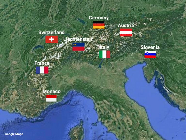 768×576 driving alps top tips routes gap decaders from thegapdecaders.com