
Map of the Brule River: A Guide to Exploring Wisconsin’s Premier Trout Stream The Brule River, also known as the Bois Brule River, is a famed trout stream in northwestern Wisconsin, renowned for its challenging currents, pristine waters, and stunning natural beauty. Understanding the geography of the river is crucial for anglers, kayakers, hikers, and anyone seeking to experience its unique charm. While traditional paper maps still hold value, online interactive maps provide detailed information and accessibility for planning your Brule adventure. Key features to consider on a map of the Brule: * **River Sections:** The Brule is often divided into the Upper Brule (above Stone’s Bridge), the Middle Brule (Stone’s Bridge to Highway 2), and the Lower Brule (Highway 2 to Lake Superior). Each section offers distinct characteristics. The Upper Brule is typically smaller and faster, ideal for wading and fly fishing. The Middle Brule broadens and slows, suitable for canoeing and kayaking. The Lower Brule meanders through cedar swamps before emptying into Lake Superior. Maps will clearly delineate these sections. * **Access Points:** Identifying public access points is vital. Maps will show locations of parking areas, boat launches, and trailheads. The Wisconsin Department of Natural Resources (DNR) provides maps indicating these crucial entry and exit points for anglers and boaters, often highlighting areas with maintained facilities. * **Tributaries:** Numerous smaller streams feed into the Brule, influencing its flow and providing important trout habitat. Knowing the location of tributaries like the Nebagamon River, the Little Brule, and Wilson Creek can assist anglers in locating productive fishing spots and understanding the river’s hydrology. * **Land Ownership:** Maps can illustrate land ownership along the river corridor. Public lands, such as the Brule River State Forest, offer recreational opportunities, while private land requires respect and adherence to trespass laws. Knowing the ownership boundaries is essential for responsible recreation. * **Topography:** Contour lines and elevation markers on a map reveal the surrounding terrain. This is particularly useful for hikers and anglers who need to navigate the steep banks and forested areas adjacent to the river. The map helps visualize the river’s gradient and predict water flow characteristics. * **Roads and Trails:** Detailed maps show the network of roads and trails that parallel or cross the Brule River. This allows for planning scenic drives, hiking excursions, or simply finding the most convenient route to a desired fishing location. * **Special Regulations:** Areas with specific fishing regulations, such as catch-and-release zones or restricted fishing seasons, are often indicated on maps provided by the DNR. These regulations are designed to protect the river’s trout population and ensure sustainable fishing practices. Consulting a detailed map of the Brule River, whether a printed version or an interactive online resource, significantly enhances any visit. By understanding the river’s layout, access points, surrounding terrain, and regulations, individuals can maximize their enjoyment while minimizing their impact on this valuable natural resource. Always check for the most up-to-date information before embarking on your Brule adventure.
 232×300 brule river watershed map brule river preservation from bruleriverpreservation.org
  444×900 brule river fishing map alexia lorraine from beitrisoevvy.pages.dev
  462×561 brule river state forest from trailmeister.com
  750×512 brule river canoe map austin george blog from storage.googleapis.com
  400×273 lake superior streams brule river from www.lakesuperiorstreams.org
  570×734 bois brule river map fly box personalized handcrafted etsy from www.etsy.com
 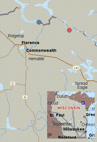 342×496 map brule river wisconsin white water brule river dam ryneers from www.riverfacts.com
  599×1132 map bois brule river study area including major tributaries from www.researchgate.net
  209×300 brule river state forest map brule river preservation from bruleriverpreservation.org
  768×1085 trail map brule river riders from bruleriverriders.com
  763×240 hikes trails brule river state forest alltrails from www.alltrails.com
  736×961 bois brule river wisconsin cherry wood fly fishing river map from www.pinterest.com
  710×733 diy guide fly fishing brule river michigan diy fly fishing from diyflyfishing.com
  492×480 brule river flowage fishing map nautical charts app from www.gpsnauticalcharts.com
  902×579 brule river map jamie inglis blog from storage.googleapis.com
 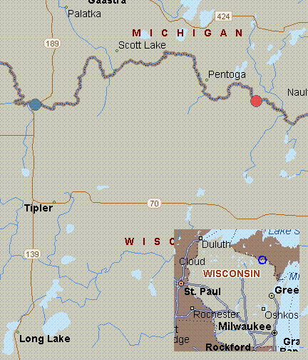 432×504 map brule river wisconsin white water highway fs from www.riverfacts.com
  474×298 topographical map brule river sec part sec from www.wisconsinhistory.org
  295×240 brule river wisconsin reviews map alltrails from www.alltrails.com
  490×1024 upper river map brule river sportsmens club from bruleriversportsmensclub.com
  666×410 map brule river minnesota white water northern light lake from www.riverfacts.com
  600×350 trails brule river state forest wisconsin alltrails from www.alltrails.com
  120×187 wisconsin state fishing maps from www.ncfishandgame.com